|
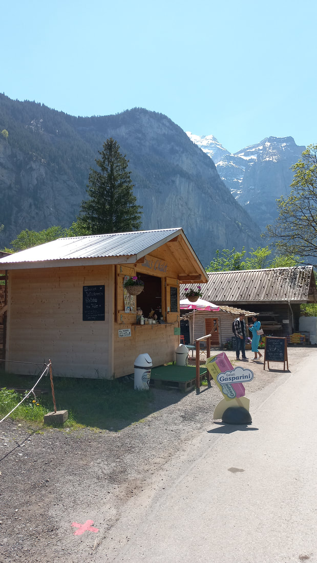
As the snow begins to melt and we wave goodbye to our winter playground, the valley gets louder. Loud from many more rushing waters as the snow melts and the smaller watercourses burst out of the majestically high rock faces from the force of the groundwater behind them. Of course the name ‘Lauterbrunnen’ means loud fountains and that is very true. Looking up the 300 metre steep cliffs, especially on the left hand side heading toward Stechelberg, one can often spot these random water spurts bursting through. That is how the valley waterfall count can get as high as or even higher than 72 😊 Sitting on the right-hand side of the train up to Wengen, I think one gets the best views. Also one comes close to the 6 or so waterfalls rushing over the Wengen side rock ridge. Sometimes hard to read the names quickly, however most of them are named. What is a better experience, is to walk up, or down the path to Wengen. One can come closer to these waterfalls hidden by forest and rock ridges. On one hairpin walking track bend, after passing under the arch of an old rocky rail bridge over head, one can see the old train track that has a chain across it. For the adventurous, the walk along this old track is at your own risk and takes you nearer to these exciting gushing waters. A Flühli (or Flue) is characteristic of rock formations and rock peaks embedded in gentler shapes, mostly made of limestone. Flühli is describing the chimney-like formation where the watercourse races through. 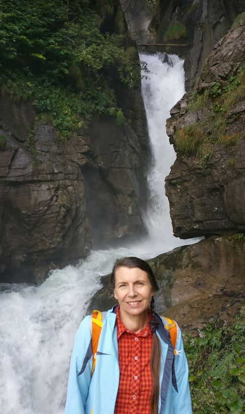 Chilbiflühli Other enjoyment options include walking along the paths that are usually only available in summer. This year with much sun, has revealed the summer paths already behind Wengen. And what a delightful series of hiking paths there are, for example the Gemsen Weg. Gemsen are Chamois or goats who live up in the rocky parts overlooking Wengen. Taking the path out of Wengen at the end of the village, turn right and past the Cinema /Kino and head for part of the Gemsen Weg. The Gemsen Weg proper, zig zags up under the Männlichen cable car to the peak. However there is a round path that also brings you back through the forest and into the village. Or left at the end of the village towards the reformed church with its fabulous views of the Lauterbrunnen Valley steeply below. Then continue along the path, after the Hotel Bellevue veer to the right towards Hunneflue. At the Hunneflue, you are looking down toward Zweilütschinen and Wilderswil. From here it is possible to also choose the route via Leiterhorn or a round trip that includes part of the Gemsen weg back into Wengen. There are seats along the way that are needed to take in the spectacular views. 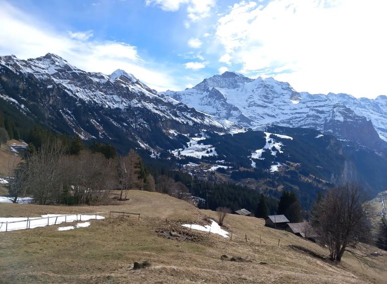 View along return path to Wengen from Hunneflue. Peaks left to right: Lauberhorn, Mönch and Jungfrau. 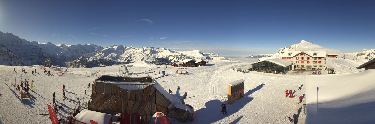 This view is from the top of the Männlichen Cabelcar The Männlichen Cabelcar set a technical record in 1957 as the longest single-cable gondola in Europe with a length of 6.2 kilometers. Total journey time was around half an hour and gave one time to eat a picnic lunch in winter to get ready for the afternoon’s skiing. It is faster now. In 1978, it was also the first gondola lift to have so-called rubber band accelerators, which enable comfortable acceleration and deceleration of the gondolas in the stations. Now, one can sing one’s way to the top in one of the 2 Karaoke Gondolas! The website says, “The greatest music hits of all time are waiting to be chosen and can be performed together with the other gondola guests. And of course there are soothing Ricola sweets available so that you can make the most of your singing potential.” 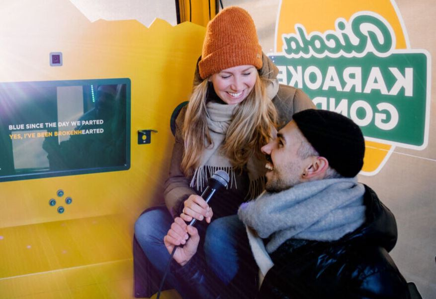 Sources:
https://www.maennlichen.ch/en/winter/experiences/ricola-karaoke-gondola.html https://www.enviadi.com/blog/maennlichenbahn-grindelwald/ With the cooler December months come Christmas markets and Mulled wine, or Glühwein. Glühwein literally translates as "Glowing Wine", the name being derived from the time when hot irons were used to heat the drink. If you have not tasted it, then you can make your own. It is a hot beverage consisting of red wine that is gently heated with with various spices such as cinnamon, anis, cloves, cardamom, and citrus fruits. A non-alcoholic mulled wine is called Kinderpunsch. Ingredients 1.5 liter red wine 2 bottles 75 cl each 4 oranges untreated 5 cloves 3 Cinnamon Sticks 3 star anise 75 ml rum or brandy (optional) 100gr brown sugar if you can get Belgium Rock Sugar How to: Slice two oranges and juice the two remaining oranges. Add the red wine, orange slices, and freshly pressed orange juice and spices in a pot. Gently heat the mixture at a low temperature. Do not let it boil! The ideal temperature is 72°C/ 161 °F. Anything over 78°C/172,4°F and the alcohol will evaporate. You can best check this with a cooking thermometer. Optional Step: leave the Glühwein to sit for an hour or two and then reheat. This will allow for the spices to fully develop their flavour. I don’t add sugar, as a good wine can speak for itself. But if using a cheaper wine, add some sugar. The right amount of sugar will depend on your personal taste. For an extra warmth factor, add in some brandy or rum. To serve, strain out the orange slices and spices and serve the wine hot. You can also make it in a slow cooker or crock pot so that it will keep warm for your outdoor Grill Fest or BBQ in the crisp winter air. 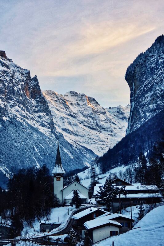 Why not save the disappointment of not reaching the “I’m going to do this….” And plunge into dismal disenchantment when you haven’t lost those extra Christmas kilos by Easter. The ancient Babylonians came up with the idea of promising new things to their gods at the beginning of their year. And we are still doing it! A long tradition of four thousand years, we are still talking about our ‘next year’ plans. Since ‘resolutions’ is such a hard word, maybe that is why they don’t stick, but maybe think of dreams and new habits instead. How could that be different? A dream is something you’d like to get done at some point in life. For example, “I’d like to walk the Mönch peak track” or “I’d love to find the source of the Staubbach.” They can be something just around the corner or something that might take several years to work up to. Apparently the best goals are the ones that are just out of reach at the present moment. If you can put an easy timeline and deadline to it and knowing that you could do it, then , its probably not big enough to be a dream but a goal. A goal is a dream with a deadline. That means it is specific, measurable, achievable, relevant and with a time frame. For example, “I’d like to save up 2,000€ towards renovating the kitchen by June this year.” A habit is a daily or weekly activity that helps one accomplish their goals. For example, “I’m going to ditch my Netflix account and put that money towards the kitchen.” A habit helps put structure around a goal, making it more attainable. Maybe instead of a resolution, we need to spend more time dreaming about what we want out of life. Then we could take those dreams and start turning them into goals and habits. Then maybe at year end the dreams have come true. 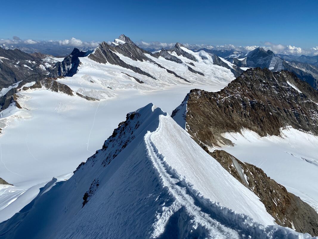 Photo: Mönch South-East Ridge, near the top October 2, 2020 Jean-Nicolas Fahrenberg
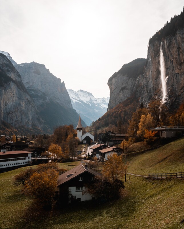 Summer has slowly waved farewell and autumn has been boasting its colours to beautify the valley in gold before the shorter winter days and snow appear.
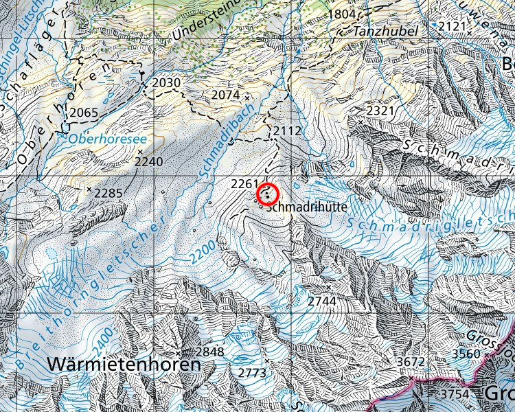
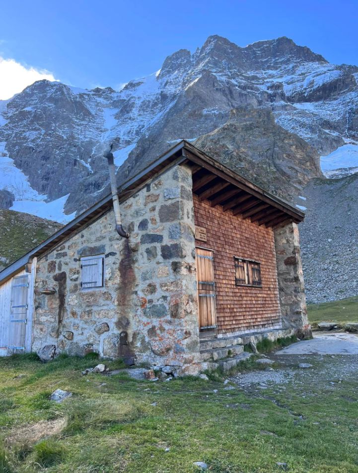
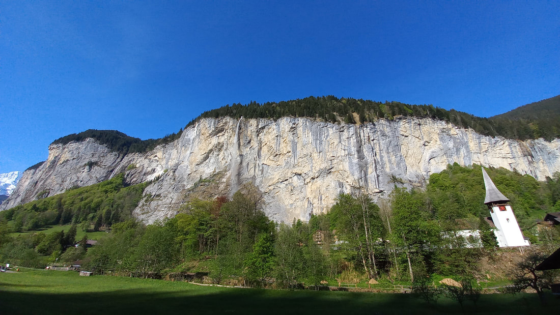
November is a time when many businesses try and take a month of rest. They seek some remaining warm weather a little further south to get recharged in readiness for winter visitors. This summer has been full in the valley, with many more visitors than usual as people have begun to travel again after Covid put their plans on hold. This has caused quite an overload this year on the valley of Lauterbrunnen and the services offered by the local council, such as toilets and parking. So what is it like to live in a village that has suddenly become an Instagram favourite? Here are some comments from local residents at a local meeting….. “We feel like employees at an amusement park” “We are almost desperate, we locals simply have no room left in Lauterbrunnen,” At a local residents meeting, it was clearly said that Day-trippers are problematic for traffic because they come just to see the Staubbach waterfall and leave without even buying a coffee, “They come in a rental car, take photos of the Staubbach Falls and then leave again.” This leads to traffic chaos: “I have the feeling that I live next to a motorway, people drive into the valley and out again. It’s annoying” Tourists walk into people's private garden areas to take photos and disrespectfully play football in the cemetery. Visitors are so awed at the Staubbach falls as they enter the village, that they will unconsciously stand in the middle of the narrow road to take photos of the Falls and become a traffic hazard themselves and cause danger to drivers. A quaint little rural village, that only has a narrow footpath on one side through the village, has a lot of congestion when tourists are not mindful to look out for their own safety. We welcome you to Lauterbrunnen, to enjoy the beauty of nature and the many other offerings here. Now you know what it can be like for residents to share their village with the holiday makers we all like to welcome. Source: https://www.srf.ch/news/schweiz/tourismusflut-in-lauterbrunnen-wir-fuehlen-uns-wie-angestellte-in-einem-freizeitpark Photo: Willian Justen de Vasconcellos The beauty of fall or autumn colours in Lauterbrunnen in October is truly spectacular. This forests come alive with vibrant autumn hues during this time of year. The weather can be quite variable, with daytime temperatures typically ranging from 8°C to 15°C (46°F to 59°F). Nights can be chilly, with temperatures dropping to around 0°C to 5°C (32°F to 41°F). It's essential to pack layers and be prepared for cooler weather, especially if you plan to hike. Our laundry is an excellent place to dry clothes or store muddy boots. As the leaves on the trees change colours, the entire valley transforms into a sea of gold, red, orange, and yellow. The contrast between the colourful trees and the rugged, snow-capped peaks of the surrounding mountains is breathtaking. As the melting summer snow contributes to higher water flow, the waterfalls remain on full power. However, some attractions may have reduced hours or accessibility. However you can always watch the Staubbach falls from our balcony directly opposite. It waterfall plunges from a cliff with a height of approximately 297 meters (974 feet). It's one of the tallest free-falling waterfalls in Europe. It is a sight to behold as it tumbles down from the cliffside amidst the changing leaves. It appears almost like a veil of water, especially when there's a gentle breeze causing the water to disperse into fine mist or dust, the German word is "staub," which gives the waterfall its name. Depending on the weather, the track up to the falls themselves may be closed. Staubbach Falls has also inspired poets and writers, including Johann David Wyss, who mentioned it in his novel "The Swiss Family Robinson." There are many waterfalls in the valley, this photo is of the Spiessbach, just along from the Staubbach falls. The hiking trails around Lauterbrunnen become even more picturesque in October. You can explore paths that wind through forests and meadows, offering stunning vistas of the valley and the surrounding mountains. Popular hikes like the one to Mürren or Wengen allow you to immerse yourself in the autumnal beauty. The soft, diffused light of fall enhances the colours and provides excellent conditions for capturing the beauty of the landscape with your smartphone. There are fewer crowds compared to the summer months so you can enjoy the natural beauty in a more peaceful and relaxed environment. 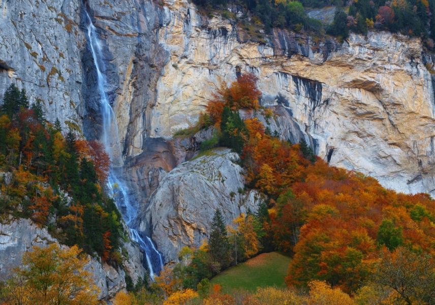 Ever wanted to sleep high in the mountains, say 2260 meters in a cozy rustic mountain hut? Only sleeping 8 people with a confirmed reservation, the Schradrihutte is at the south-east end of the Lauterbrunnen Valley in the nature reserve called Hinteres Lauterbrunnental. Coordinates WGS 84: 46.49914, 7.89231 or 46°29'56.921″N 7°53'32.313″E The wardens are not on site but wood and basic Cooking facilities with wood stove are supplied. Only 1 lamp, so bring some candles, and running water is about 30m south of the hut. Rustic, quiet and just a beautiful walk to arrive there. From Stechelberg, in the direction of Oberhoresee via Tanzhubel and up beside the magnificent Schradribach Waterfall, you will be well rewarded with stunning views and in mountain peace. Reservations here: https://www.aacb.ch/huetten/schmadrihuette/#OnlinereservationSchlafplaetze 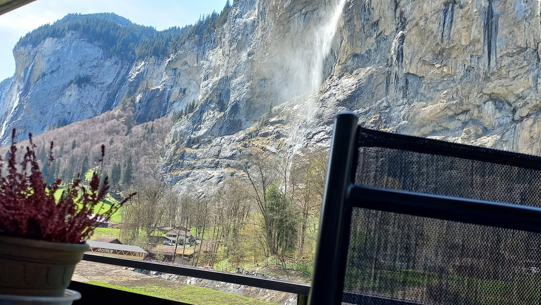 “I almost wish we were butterflies and liv'd but three summer days - three such days with you I could fill with more delight than fifty common years could ever contain.”
― John Keats, Bright Star: Love Letters and Poems of John Keats to Fanny Brawne 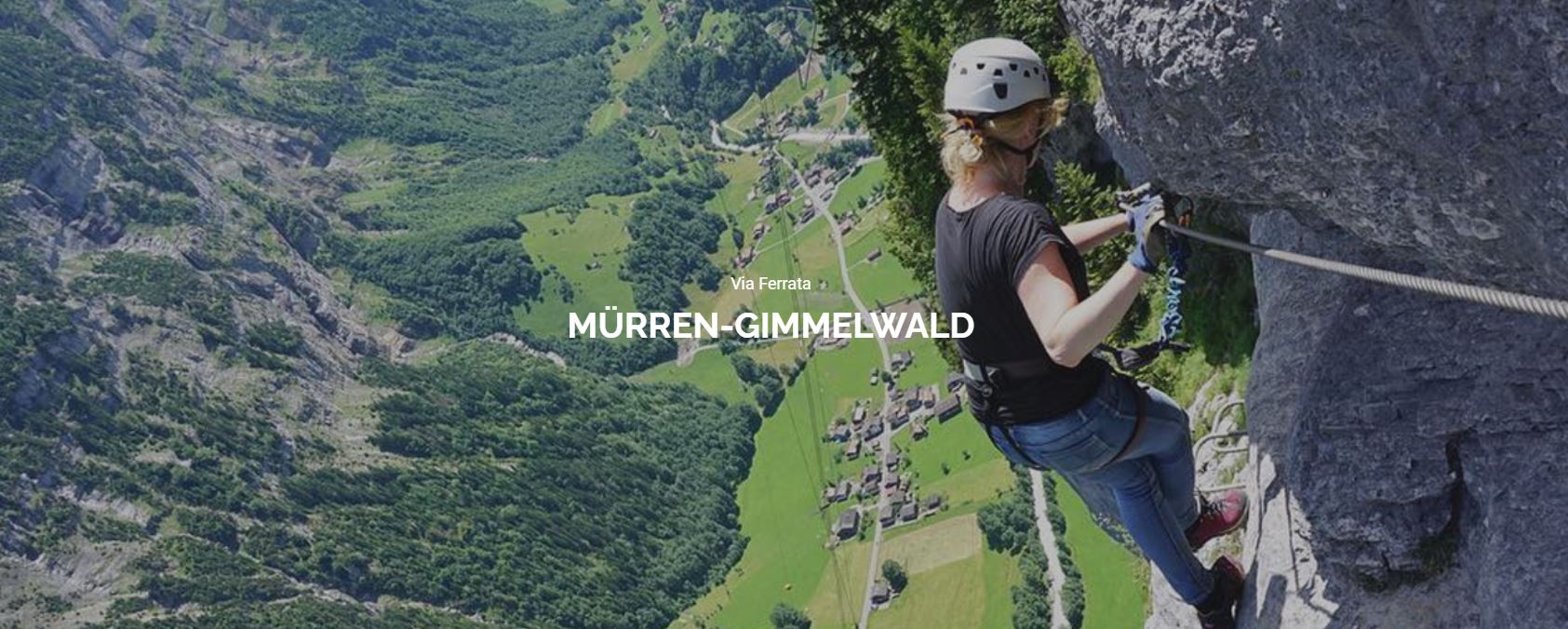 Via ferrata is Italian for “iron road” and is part hiking, part rock climbing, and part sturdy adventurous. On a via ferrata you follow a path that consists mainly of iron rungs attached to the mountainside all the while being clipped onto a steel cable.
1.A ferrata from Murren to Gimmelwald. You can do it without a guide. About 3 hours, 2 km. For a non climber it was incredibly scary as you walk around the rock face but it is mega specular as there is 400 meters of nothing below you. It is made up of a couple of tightrope canyon crossings, a Nepalese of suspension bridge and ladders. Think of it as a high up ropes park. https://www.klettersteig-muerren.ch/index.php/de/ https://www.switzerlandical.com/murren-via-ferrata/ There is a Hostel that sells burgers and food in Gimmelwald with the most amazing view from their deck. 2. Also from Gimmelwald, there is a "climbing garden". From the village of Gimmelwald it is a 50-minute walk to the foot of the wall. Follow the gravel road towards Chilchbalm. After crossing the river, a path leads up to the wall on the right. At the Chilchbalm, the end of the small valley, one can see the receding glacier, it is a magical walk that many people don't know about. 3. There is also a family friendly climbing garden on the Riggli. From the Birg station (middle station of the Schilthornbahn). From Birg you follow the white signposts downhill through the Engetal and after about 40 minutes you are at the foot of the wall, a few minutes' walk below the Schilthornhütte. 4.The Rotstock Via Ferrata is a family climb right next to the famous North Face Wall of Eiger. Using a harness, stairs and metal stairs you can climb 400m of incline to the 360-degree panoramic viewpoint. You can get there from the Eigergletscher Station which is above the Kleine Scheidegg station on the train route to Jungfraujoch. It is marked with the blue and white mountain standard trail signs. Of course there is the Eiger - need I say more :) 5. Also from Eigergletscher Station is a blue and white graded walk to the ´Guggi hut that needs some athletic climbing skills but well worth it for the views and the traverse so close to the glaciers. 6. Mönch ridge walk is also a must do....walking toward the Mönch hut ís about an hour walk from Jungfrau Joch train station but before the hut you go up the southeast ridge. The lower section of the climb will lead you to the rain gauge, and from there you will easily climb to the first snow ridge. There is snow along the way but it is not far. You can do it as a day trip when you start early. BE the adventurer. 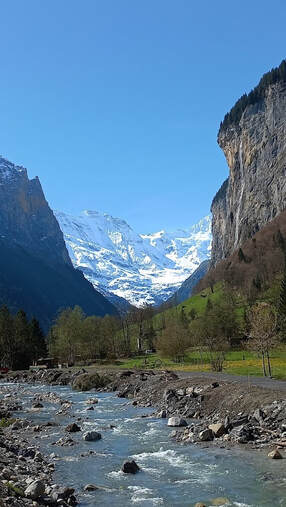 The life of a river is complicated. Complicated by changing weather patterns and seasons. The raging Weisse Lütchine is always underway carrying massive amounts I glacial moraine from melting glaciers and capturing the many rivers, streams and tributaries that come into this ancient Lauterbrunnen Valley.
A stroll beside the Weisse Lütchine from Stechelberg to Lauterbrunnen will give you an appreciation for how it changes in mood , speed and sound. Always a postcard, it is rarely not featured in famous Insta shot spots. The constant river management projects of the local council can be seen at many points along the length of the Weisse Lütchine before it joins up with it’s sister from Grindelwald, the Schwarz Lütschine at their rendezvous point in Zweilütchine. Widening the river helps to slow down this bustling river and protect the adjoining farming pastures from flooding. The valley was first and will always be, a significant agricultural region. So the farmers are most grateful and of course the canoeists who enjoy the swiftness are still never disappointed with the changes. Your passion is extreme sports in the mountains? Then canyoning could be for you. You are torn: dare to do it or rather go paddling instead? Only after you have had this full on experience will you know if canyoning is the right sport for you. 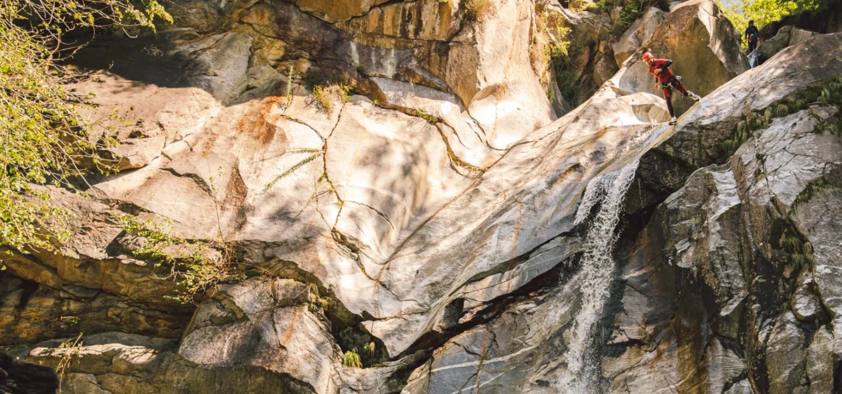 -Suspended in the air, attached to a rope, and that's just the beginning. A breathtaking adventure, you will discover a unique and exciting activity.
With a helmet, wetsuit and harness, you'll throw yourself down rocks, ditches, waterfalls and deep gorges. As you whiz down these natural slides and let yourself be carried away by the water, the feelings are indescribable. "Try it out" is the motto! Experience this insane moment where the adrenaline will soar. In a safe way, of course. It was explained to you: once the fears are overcome, everything else is downhill. I mean, running downhill, down a rock face....totally exhilarating. And abseiling through a waterfall is just the best. Only from May to October. Contact: Outdoor Switzerland AG Hauptstrasse 15 3800 Matten bei Interlaken Schweiz Phone: +41 33 224 07 04 E-mail: [email protected] Website: www.outdoor.ch/en Need to know - Canyoning is only possible in the summer (May-October) - Whether or not the tours can go ahead depends on weather conditions and water levels - You will be provided with all the necessary equipment (neoprene suit, helmet and life jacket) - Please bring the following with you: Swimming costume, large towel, small backpack, money for video and souvenirs - Swimming ability: recommended but not essential - Fitness: physically fit - Minimum age: 12 (beginners’ tour) - Weight: Max 125 kg 3 kilometers, 600 meters in altitude and an average gradient of 20%.. 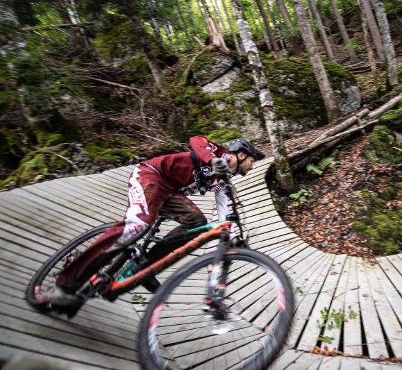 Photo from https://velosolutions.com/
The Grütsch trail in Lauterbrunnen offers advanced bikers a real challenge. The ground is constantly changing. From the dusty ground to rocks, roots and North Shore elements, everything is there. The trail is steep and the turns are tight. Nevertheless, the track is incredibly smooth. "As the name "Grütsch" already suggests in Bern German, it is a large landslide. The big boulders in the lower part of the route were an enormous challenge for the shape crew. Since blasting was not a solution, the crew quickly built north shore constructions over the cairns. The cable car takes bikers comfortably to the start on the Grütschalp. When you get hungry or thirsty, you can sit on one of the terraces of the base bars on Dorfstrasse. And Vernon at Imboden Bike shop in Lauterbrunnen can fit you out with whatever bike gear you need. www.coop.ch/en/Online-Supermarket.htmlNo car during your stay and feeling like cooking? Just shop online! We have always found the prices at the Coop store in Lauterbrunnen to be the same as in Interlaken and also at, Murren and Wengen. Of course the range is not the same in Lauterbrunnen as it is in Interlaken. Coop offer online shopping, you can have it delivered (free if over 200CHF) or you can pick it up in Lauterbrunnen for free. At Camping Jungfrau, their small store offers a range of not-so-cheap grocery and fresh bread options. A lot of local items from the region: cheese, for example, beer, bread and croissants from Beck. Plus souvenirs. It is a short walk left along the Weiße Lütchine, then over the wooden Bridge. Their restaurant called Restaurant Weidstübli is fantastic, but you need to book. +41 33 856 20 10 If you have a car, some of the most uncrowded grocery shopping and easy parking is at the Oberland Centre just 2 minutes drive from Wildersvil. Here you can park undercover and there is a Migros Store (comparable to Coop) and a cheaper Denner next door. www.oberlandshopping.ch Address: Aegertiweg 33 3812 Wilderswil You can park for 2 hours free of charge (but your car number must be entered at the machine). Also Bus line 105 stops right in front of Oberland Shopping. 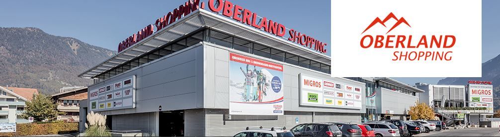 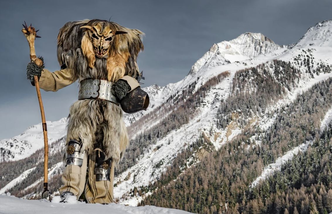 Just an hour and a half by car (or 2 and a half by train) on the other side of the Breithorn, the tallest peak that you can see from the balcony, is the village of Lötschental.
Do you dare to cross the mountain? At Carnival, these Tschäggättä masked figures will appear in the Lötschental. These bestial creatures are in fact locals from the valley who wear old clothes inside out, with the fur facing outwards. They are covered by two pieces of sheepskin or goatskin, held together by a leather belt with a cow bell ("Trichla") usually hanging down from their leather belt. Hiding behind their handmade wooden masks, they run alone or in groups through the narrow streets of the mountain villages and frighten those around them and play pranks. This tradition sometimes became so reckless that the Church repeatedly had to prohibit it. Today, the Tschäggättä chiefly roam the valley on "Dirty Thursday",(Shrove Thursday) and hunt down and frighten anyone who is still out on the streets. There is a masked parade in the village of Wiler on the Saturday prior to Ash Wednesday. The remote valley in the canton of Valais has only been connected to the outside world by a paved road since 1954. And so customs have survived here that are no longer known elsewhere. The Tschäggätta are the most spectacular proof of this. In the mountain village of Blatten, the last town in the narrow valley, holidaymakers can see the best mask specimens. The "Maskenkeller" is a small museum and houses particularly impressive masks. https://www.loetschentalermuseum.ch/tragmaske-6/ No one really knows were the custom originated. However a story of the shady side of the valley with even poorer inhabitants is also often told: In order to be able to steal a few groceries from their more affluent neighbors on the sunny side without being recognized, they are said to have disguised themselves and thus established the custom. You can do a mask carving workshop for 49CHF https://www.loetschental.ch/de/sommer/gruppenangebote/maskenschnitzen-79 The Carnival in Lötschental is from 03.02.2023 to 21.02.2023 Tschäggättä-Procession from Blatten to Ferden: 8pm 16. February Carnival masquerade in Wiler: 3pm 18. February 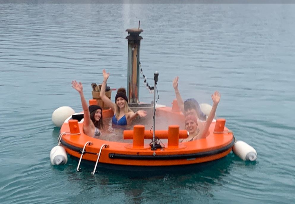 Hot Tug by Pirate Bay in Brienz Up to 3 people can enjoy their own private and unique wellness spa in 38°C warm water in a private tug boat on Lake Brienz. 248CHF for 90 minutes including a refreshment drink.www.pirate-bay.ch/de/hottug/wellness-hotpot-boot/
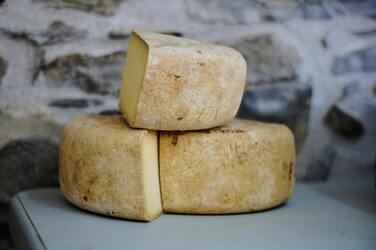 Mountain Cheese Mountain Cheese Listening to local myths and stories in a culture can really help to reveal characteristics of local people groups. The community of Lauterbrunnen is traditionally one of dairy farming. Since cheese is an elemental product in the livelihood of the farmers, so does it also takes centre stage in a tale from Aarau around the 1800’s.
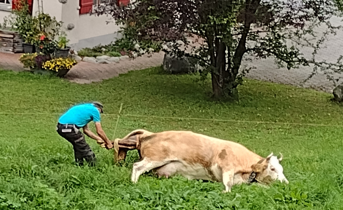
One day, while looking out over his caramel and white cows enjoying their summer grass, Hans the young shepherd thought that perhaps he wanted to get married. And then he could be as contented as his cows in their high pastures. Surrounded by snow capped mountains, gurgling streams and the chirping of Marmots, Hans thought that being married, would bring fulfilment to his life. Fortunately, Hans already knew three local sisters with whom he had been in school but he had not heard news of them since his years working on the alps in summer and in a garage in winter. Hans recalled that they were all equally beautiful and that they had all given him attention in class, such that he couldn’t think he had a favourite. Hans mused over his memories of class times and teasing the girls by slipping half dead crickets into the pockets of their aprons and how he was punished with cow pats rubbed into his hair. Hans chuckled at the screams he remembered over the crickets. Such small harmless insects that always made a big impact. Beate, Dorina and Luzia were “townies” and not familiar with collecting insects and he wondered if they would make a suitable farming partner. Hans decided to ask his mother, since she knew about girls and she was delighted to answer him, “If you want me to give you good advice," she said to him, "invite all three sisters over for supper and set out cheese for each of them and see how they handle it." The son followed this advice and invited the young ladies to his house and set the delicious matured Mountain cheese in front of them. He had made it himself and it had matured two years in a cool cave. Beate, with the cheeky smile and chubby cheeks was the first to take her piece and greedily devoured the cheese. She ate so quickly, including the rind, so that not a trace was left. Then Dorina, with her high forehead and wide smile, took the knife and cut off the rind so thick that the piece with the rind that she threw away contained a lot of quality cheese on it. Hans was dismayed, that his hard work of shaping and pressing the cheeses was not understood on someone who could throw it away. Slowly he looked to Luzia, who had waited for her turn to use the knife. With slow and careful slicing, Luzia, with the freckles and short nose, calmly peeled the rind clean from the cheese, just as it should be. “I’ll get us apples to eat” said Hans getting up from the table and he walked outside to where the apples were stored. Seeing his mother sitting in the sun peeling beans, Hans updated his mother on how the cheese tasting was going. His mother advised: "Take the third one, she will bring you luck." And so Hans chose Luiza to be his bride, and throughout his life he has never regretted that he had followed his mother’s advice. From: Otto Sutermeister: Children's and Household Tales from Switzerland (Aarau 1869), No. 39. The Swiss fairy tale has been found in a very similar way in Grimm's collection since 1819 under the title "Die Brautschau", KHM 155. Parabla 2011-03 When we get asked about November weather we are always honest with potential guests. We say that many businesses take a rest in the valley to recover from summer and get ready for winter. So that while many restaurants may be closed for renovations, the Co op grocery store however, is always open since the locals still need to eat and school is in progress. It is a good time to experience the valley like a local without the summer stream of visitors. The valley takes on a mystical mood and a hush as it breathes a sigh from the busyness of summer. As the earth gives up its warmth, the cold air condenses to a fog, mist or low cloud, although not everyday. That eerie Tolkin atmosphere creeps in and one feels the anticipation that change is coming. As indeed it is and the season moves into bright and beautiful colours with a crispness in the air. A short ride to Wengen or Mürren and one can be in brilliant sunshine and look down at the low cloud cover over the valley. The photo below is above Mürren. An easy 20 minute walk up from the station passing some local farms. It is very peaceful with a mysteriousness in front of you with one of Nature’s cloudblankets in front of you. Unless early snow has fallen up high at Kleene Scheidegg, you can walk down to Wengen, or over to Männlichen or up the Lauberhorn. Of course there is also the “other side” of the valley at Mürren. In both cases the trip to the Jungfraujoch and the Schilthorn are available all year. Both have other activities, dining and spectacular views. 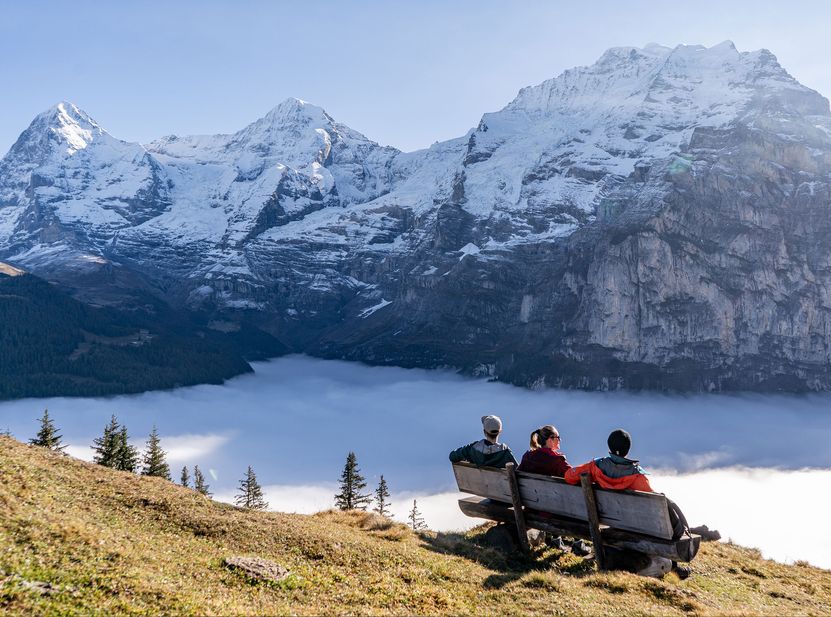 Lots of special things seem to happen for guests. Here, a guest saw the birth of a calf in the meadow in front of the Eyhus. Dairying has been a tradi8n in the valley however it is hard work, no holidays and low income. The average farm size is 18 hectares. These beautiful cows yield around 7000kg of milk per cow per year. That’s about 30 litres a day. Their price is around 4000 sFr.but to their owners they are priceless and are well cared for, even getting a regular wash. Each cow has a name The diet of mixed meadow grasses and fresh water, really influence the flavour of the milk and then naturally the cheesed produced. A walk along the Farm road al8ng from the Staubbach Falls is a must where you can buy local farm cheese and sometimes fresh milk. The dairy on the path from Grütschalp to Mürren has a show window where you can view their production. Some slices of cheese on fresh bread are a hiking picnic must-have and you will be helping the farmers pass on their livelihoods to the next generation. People often ask when is the best time for wildflowers in the Berner Oberland region. There are actually waves of different wildflowers from June to September. The elevation and sun facing slope angle also play their part. At lower altitudes, Spring starts in May. At Schynige Platte, the Alpine Garden at 1970 metres there mostly opens middle of May. It finishes toward the end of October (23rd October in 2022) when one sees seed pods and autumn colours There are different categories such as endangered species and climate change affected species. See www.alpengarten.ch Admission is part of the 126 year old cog rail train fare from Wildersvil and there are often tradition alp horn players there and a ch8ice of short and long walks that overlook the stunning aqua coloured Brienz Lake. Because it is the mountains, the weather is unpredictable. Snow in September was a surprise this year. However nature is full of surprises and not to be assumed. Lauterbrunnen has always been kn9w for its beauty, dramatic valley rock walls and of courser countless waterfalls. One can say countless, because after rain, there are so many more springs that burst from the rocks from the increased groundwater level from above that squishes the water out anyway it can. It would be one of the most spectacular sites in the world after rain. The waters roar, like the White Lütchine bursting and busying itself through the valley is met with most of the waterfall waters. It is spectacular. Even without rain, one can feel the power and hear the thunder of a mighty waterfall like the Mürrenbach falls next to the Schilthorn cable car station. Easy to get up close, but don’t go near the impact zone where the water is truly deadly. Iconic beauty has done well on Instagram. Now there are many daily visitors coming to the Instagram photo sites. The Tourist Bureau even has an Instagram walk that you can do. Tom, the manager there , has faithfully uploaded daily, his beautiful photography to Instagram and everyone is thronging to see where he took his stunning photos. A lush green valley with spurting waterfalls, all nearly 300 metres tall, and completely in one view. Such an eyeful and as far as you can see. Before becoming a trending social media hot spot, Lauterbrunnen enjoyed the usual day visitors by bus and guests staying in the valley who frequented the village cafes. After going viral, several more cafes have sprung up and at last Annies Chalet take away, right opposite the stunning Staubbach Falls selling ice cream and drinks. Even when being conscious of social distancing, there is plenty of space and fresh air without feeling crowded. And you don’t get people in your photos because most of the photography is up ! One of the best places for a photos of the Staubbach Falls, is from the cemetery behind it. Seats are there and few people bother to wander through the colourful graveyard to gaze at the Staubbach and the valley view up to Wengen. Naturally, the best view we think, is from the balcony of Eyhus, directly across from the Staubbach Falls. 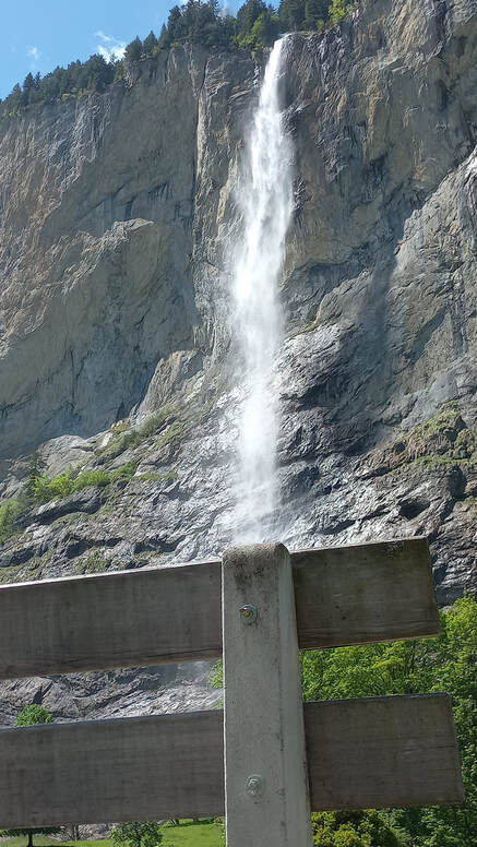 Where to sit and watch the Staubbach Falls other than on our balcony or by the stream below? The Graveyard opposite the apartment offers a few seats that are mostly vacant while people go to the Falls themselves just a short walk through the graveyard. From the apartment, you can walk directly to the Weisse Lütchine River in front of the apartment and across the bridge and up the path to the graveyard and you will find these seats at the top of the path. 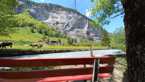 Walking left along the Weisse Lütchine River in front of the apartment, with a newly paved road hat is more stroller friendly, one passes the covered bridge. Keep walking and when you view the Heliport on your left, look right for this quiet spot where you can take in the farm economy of the valley as well as the Staubbach Falls. 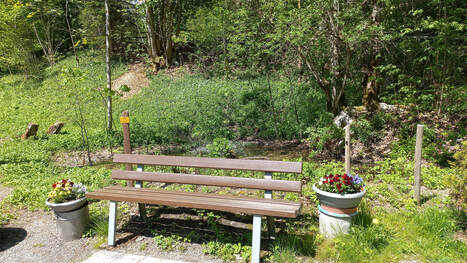
Another amazing waterfall worth watching is also nearby. Just after crossing the Weisse Lütchine River in front of the apartment, before going up towards the graveyard, you will see this seat in front of a tadpole pond. There is a lovely view back towards the Schiltwaldbach Wasserfall. Higher than the Staubbach, the Schiltwaldbach Waterfall orginates high in the Schiltwald forest not far from Innerwengen on the opposite side of the valley. 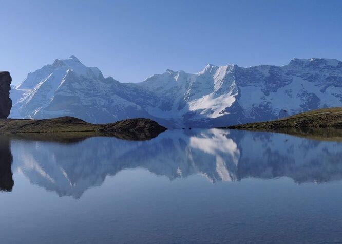 One of my favourite walks. This mirror lake, the Grauseeli, is just a little walk down from the Birg Cable Car station on the Schilthorn Cable Car route.
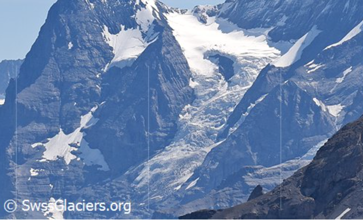
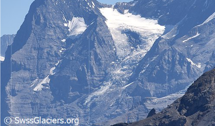
Hardly anyone visits it although most visitors on the cable car ride up to the Schilthorn may see it if they look down. It is on a walking track that leads down the valley, also one that is not so often walked. It is a red and white, mountain grade track. The full day walk (7 – 8 hours) can be done in a loop over the 11.06km with an ascent of 967 m and a descent of 964m. Beginning in Mürren and taking the path up to the Allmendhubel and then continuing up some steep parts to the Schilthornhütte which is open Fridays – Sundays from July to September for a refreshment stop before heading higher where you can see the Birg Cable car station. It is a wide and well signposted track. In winter it is part of the ski run down to Mürren and in summer it is part of the Inferno triathlon. It is a little steep down to the lake but a lovely place to rest, take a swim and many photos. The walk continues down the steep and often rocky Schiltalp trail. The rocks can make it slippery so it is best not to hurry. You will wind your way down to Mürren via the Northface trail or a longer choice is over to the Rotstockhütte for afternoon tea before walking into Mürren. A long but rewarding day facing the stunning scenic mountain range the whole day. Being up high in the world of glaciers is one of my favourite places to be. From the Eigergletscher (Eiger Glacier) rail station, one can just sit there for hours and watch the various glaciers in just one view. If you go up to the Jungfraujoch, you can marvel at the heritage protected Aletsch arena of glaciers spilling out before you. We are all a bit wobblily on the issue of climate change since we mostly feel that our small contribution of reducing our carbon footprint and use of plastics and so forth, seems to be meniscal in comparison to these ginormous and gorgeous glaciers that really are shrinking. GLAMOS (www.glamos.ch) regularly produce updated glacier inventories. Climate change is real. In the last 5 years or so, the Eiger Glacier has lost some length and thickness. https://www.glamos.ch/factsheet#/A54m-03 In 1928 The Eiger Glacier was measured to have an area around 2.62 km2. In 1973 the glacier had an area of 2.13 km2. In 2011, it covers an area of 1.54 km2 and is 2.59 km long . The relative area reduction is 30%. Photos are: left 31 07 2015 and right 21 08 2020 Source: SwissGlaciers.org 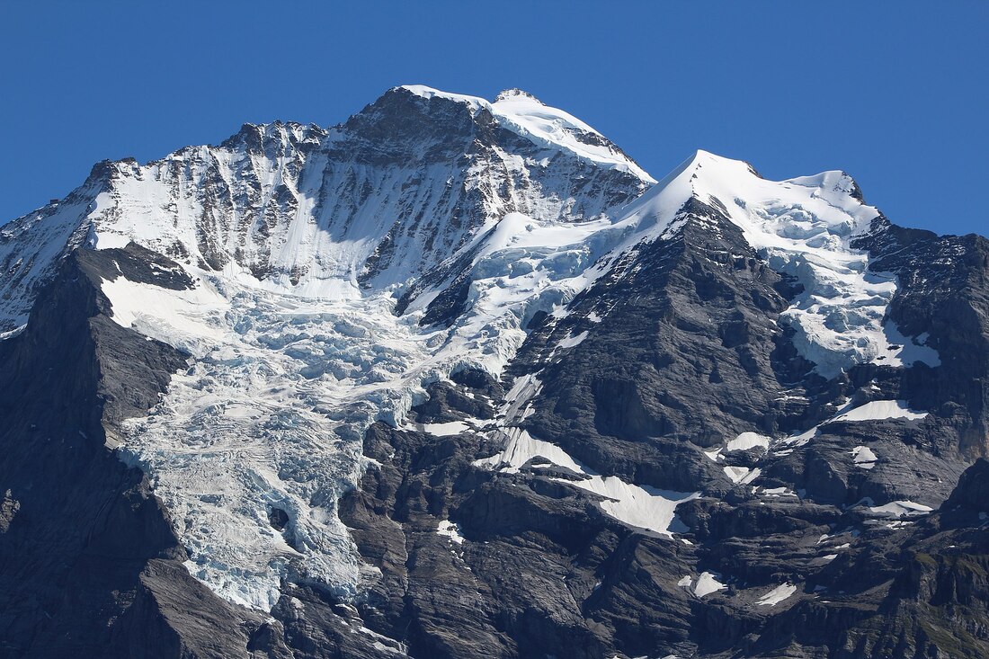 For more than 300 years, the permanent hole in the middle of the Giessen glacier has kept the people of Lauterbrunnen guessing.
The so-called war hole is a common black spot, a gap in the ice mantle of the Giessen Glacier on the north-west flank of the Jungfrau massif . It can be seen from Wengen. Whenever the spot is covered with ice, it is said that a major war will break out somewhere in the world. That was the case in the War of the Spanish Succession , in the Franco-Prussian War of 1870/71 , 1914 and 1939 , but also earlier. The hole was also covered with ice during the Gulf War and the Six Day War . An old valley myth claimed that a climber once reached the hole and reported that warm water flowed from the inside of the mountain. No one can say whether this is true. Then on June 7, 2000 the Austrian mountaineer and researcher Rudi Mayr, accompanied by the Stechelberg mountain guide Jürg Abegglen, was the first recorded person ever to climb up the war hole after Air-Glaciers' helicopter pilot Sepp Galliker dropped him off. Rudi Mayr also measured the radioactivity and cosmic radiation over a period of half an hour – all of this from the upper lip of the hanging glacier, where large boulders broke off non-stop, with the greatest risk of icefall. Mayr's comments on his findings of the same radiation exposures measured here as in Lauterbrunnen were: "possibly be resulting from thermally induced emissions of radon from the crystalline rock of the war hole." Maybe that is a glimmer of reason for the myth of warm water. The mountains hold tight to their many mysteries and secrets and at the moment there is still too much winter snow to know if the war hole has iced over with the current world wars. Foto: Bgvr - Eigenes Werk Giessengletscher von der Grütschalp aus gesehen Source: https://de.wikipedia.org/wiki/Giessengletscher Source: https://de.wikipedia.org/wiki/Kriegsloch |
Little stream below our balcony
Eyhus 5
Where dreams begin for outdoor adventures in the inspiring Jungfrau region Categories
All
Archives
April 2024
|

 RSS Feed
|
Eyhus 5,
3822 Lauterbrunnen, Schweiz Email: [email protected] About Us: We love the Jungfrau Region and enjoy helping guests to plan and discover the beauty here for themselves. Summer, Winter, Spring and Autumn each have their opportunities to give inspiration in this amazing Playground. |
Edelweiss Flowers
|