|
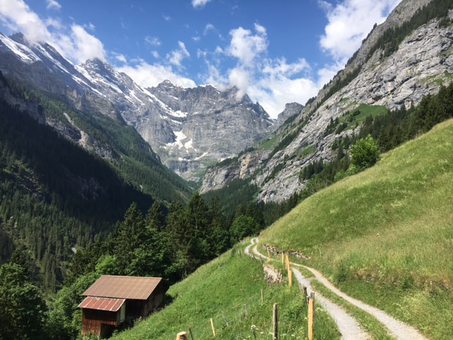
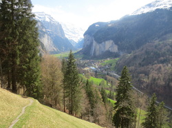
Taking a walk back in time, you can visit the “Sagi” or saw mill that was built in 1858 and still runs on just waterpower, no electricity is there. Here, trees are cut and trimmed. You need to book a tour with Mürren Tourism to see inside. You can get a glimpse on this link here https://youtu.be/pwYmC7tdskQ It is a worthwhile round walk from Gimmelwald Lift station of about 6 kilometres and stroller friendly. From Gimmelwald Lift station, head up the road passing Pension Gimmelwald and when you reach a sharp left bend marking to Im Tal. Followign this path that becomes a gravel road through a forest to a view point over the valley and you will reach the Sawmill. After the Sawmill there is another crossroad, if you turn right you will go back uphill to Gimmelwald. Photo Credi: Mürren Tourism
Despite the gushing, rushing and many fast flowing rivers and streams in Lauterbrunnen and the region that already contribute to the electricity needs, there is still a shortage of power and the search for renewable energy goes on. Soon there will be Alpine Solar farms installed. They will look a bit like the avalanche inhibiting structures that you already see high up on the mountains above villages. In alpine areas, the sun shines more often, there are fewer foggy days and the snow-covered environment reflects the light. This intense sunlight enables high electricity production all year round. Legislation on large-scale photovoltaic systems was carried out at the federal level. The municipalities are not involved in the building permit procedure for such plants. So the communities will vote on 17th June if they will accept these projects. You will also see that there is new work underway to upgrade the Schilthorn cable car structures. The region is very progressive to enable visitors an efficient and pleasant experience. Photo Credit: SchiltSolar Project, the planned photovoltaic system viewed from Wasenegg
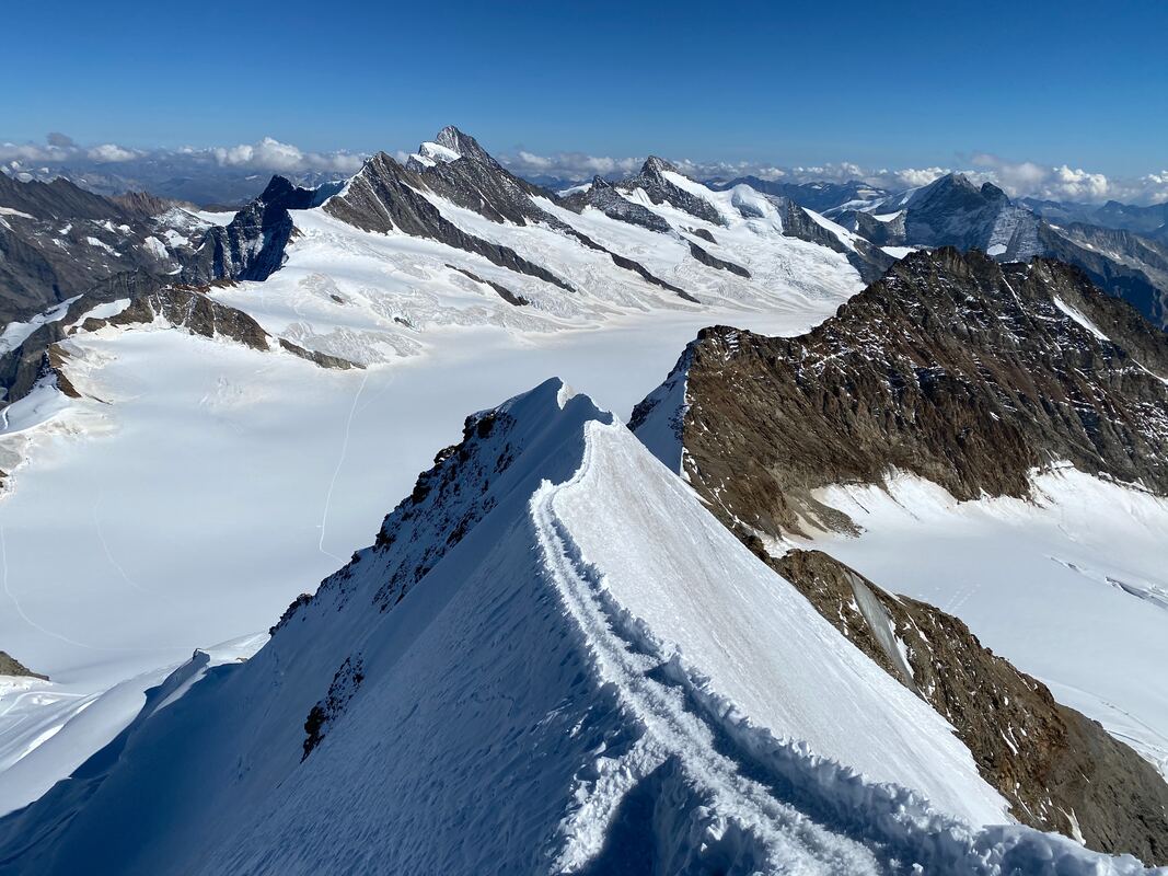
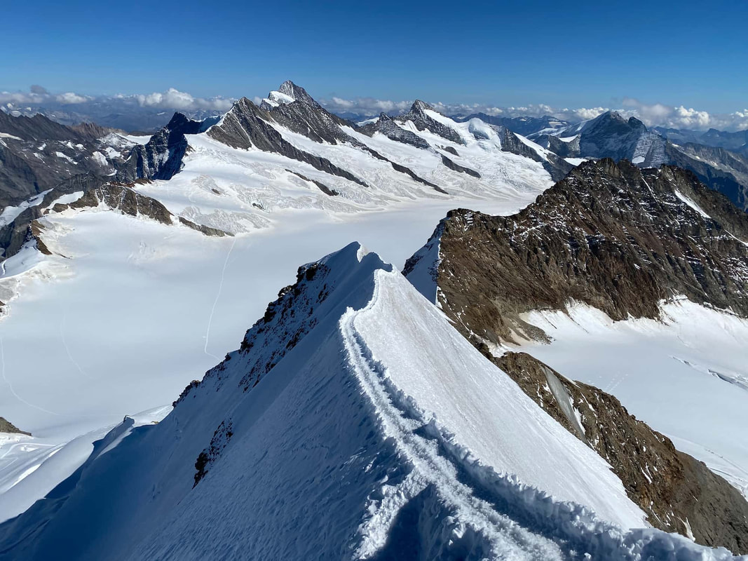
Why not save the disappointment of not reaching the “I’m going to do this….” And plunge into dismal disenchantment when you haven’t lost those extra Christmas kilos by Easter. The ancient Babylonians came up with the idea of promising new things to their gods at the beginning of their year. And we are still doing it! A long tradition of four thousand years, we are still talking about our ‘next year’ plans. Since ‘resolutions’ is such a hard word, maybe that is why they don’t stick, but maybe think of dreams and new habits instead. How could that be different? A dream is something you’d like to get done at some point in life. For example, “I’d like to walk the Mönch peak track” or “I’d love to find the source of the Staubbach.” They can be something just around the corner or something that might take several years to work up to. Apparently the best goals are the ones that are just out of reach at the present moment. If you can put an easy timeline and deadline to it and knowing that you could do it, then , its probably not big enough to be a dream but a goal. A goal is a dream with a deadline. That means it is specific, measurable, achievable, relevant and with a time frame. For example, “I’d like to save up 2,000€ towards renovating the kitchen by June this year.” A habit is a daily or weekly activity that helps one accomplish their goals. For example, “I’m going to ditch my Netflix account and put that money towards the kitchen.” A habit helps put structure around a goal, making it more attainable. Maybe instead of a resolution, we need to spend more time dreaming about what we want out of life. Then we could take those dreams and start turning them into goals and habits. Then maybe at year end the dreams have come true. Photo: Mönch South-East Ridge, near the top October 2, 2020 Jean-Nicolas Fahrenberg
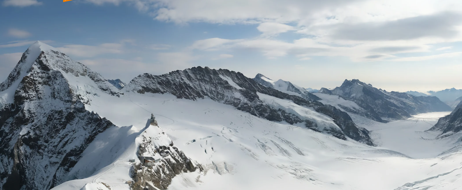
Being up high in the world of glaciers is one of my favourite places to be. From the Eigergletscher (Eiger Glacier) rail station, one can just sit there for hours and watch the various glaciers in just one view. If you go up to the Jungfraujoch, you can marvel at the heritage protected Aletsch arena of glaciers spilling out before you.
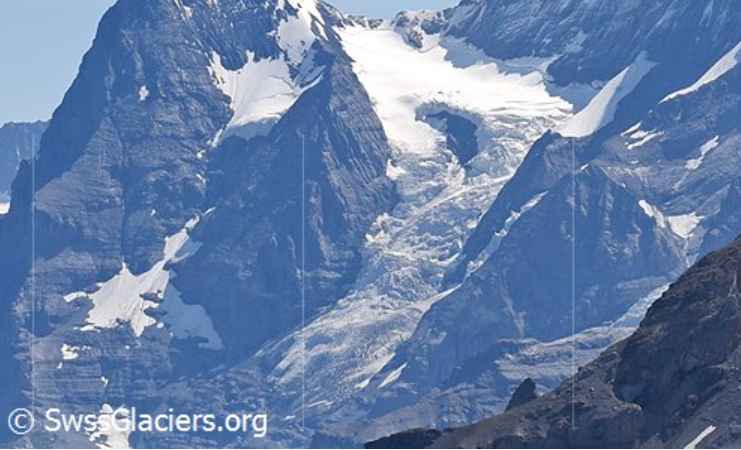
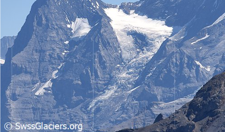
We are all a bit wobblily on the issue of climate change since we mostly feel that our small contribution of reducing our carbon footprint and use of plastics and so forth, seems to be meniscal in comparison to these ginormous and gorgeous glaciers that really are shrinking. GLAMOS (www.glamos.ch) regularly produce updated glacier inventories. Climate change is real. In the last 5 years or so, the Eiger Glacier has lost some length and thickness. https://www.glamos.ch/factsheet#/A54m-03 In 1928 The Eiger Glacier was measured to have an area around 2.62 km2. In 1973 the glacier had an area of 2.13 km2. In 2011, it covers an area of 1.54 km2 and is 2.59 km long . The relative area reduction is 30%. Photos are: left 31 07 2015 and right 21 08 2020 Source: SwissGlaciers.org For more than 300 years, the permanent hole in the middle of the Giessen glacier has kept the people of Lauterbrunnen guessing.
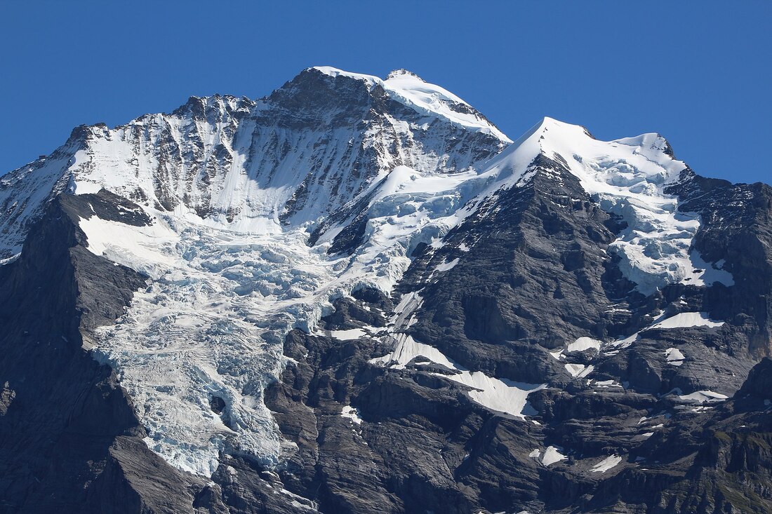
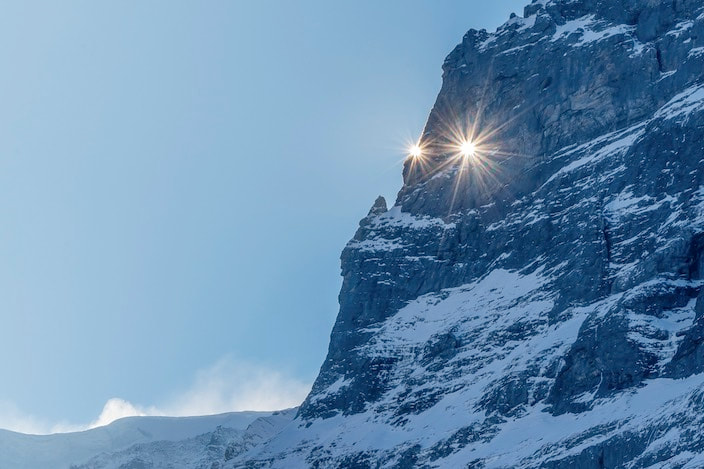
The so-called war hole is a common black spot, a gap in the ice mantle of the Giessen Glacier on the north-west flank of the Jungfrau massif . It can be seen from Wengen. Whenever the spot is covered with ice, it is said that a major war will break out somewhere in the world. That was the case in the War of the Spanish Succession , in the Franco-Prussian War of 1870/71 , 1914 and 1939 , but also earlier. The hole was also covered with ice during the Gulf War and the Six Day War . An old valley myth claimed that a climber once reached the hole and reported that warm water flowed from the inside of the mountain. No one can say whether this is true. Then on June 7, 2000 the Austrian mountaineer and researcher Rudi Mayr, accompanied by the Stechelberg mountain guide Jürg Abegglen, was the first recorded person ever to climb up the war hole after Air-Glaciers' helicopter pilot Sepp Galliker dropped him off. Rudi Mayr also measured the radioactivity and cosmic radiation over a period of half an hour – all of this from the upper lip of the hanging glacier, where large boulders broke off non-stop, with the greatest risk of icefall. Mayr's comments on his findings of the same radiation exposures measured here as in Lauterbrunnen were: "possibly be resulting from thermally induced emissions of radon from the crystalline rock of the war hole." Maybe that is a glimmer of reason for the myth of warm water. The mountains hold tight to their many mysteries and secrets and at the moment there is still too much winter snow to know if the war hole has iced over with the current world wars. Foto: Bgvr - Eigenes Werk Giessengletscher von der Grütschalp aus gesehen Source: https://de.wikipedia.org/wiki/Giessengletscher Source: https://de.wikipedia.org/wiki/Kriegsloch In mid January, the bell of the Grindelwald village church strikes twelve o'clock just before a single ray of sunshine will appear on the church square and then again in mid-November.
The sun star streams from behind the Eiger after passing through a hole in the rock about two by three meters in size to make the star. The rock window is called Martins Loch (hole) and is said to have been formed this way…… Once upon a time, a giant named Martin once lived at the foot of the Eiger. In those days, there were no glaciers in the valley. The Eiger and Mettenberg stood next to each other, and there was no five-hundred-meter-wide canyon between Bäregg and Bonerren to let the ice flow in between. Only a small gap, a hole in the rock, let temporarily, the melt water pass through and it was mixed with ice blocks, that then dammed behind the rock barrier. Then the glacier creek roared in high waterfalls down into the rocky steps into the forest. But the pressure of the water and ice could get too powerful. Then the dam would break here and there, and a devastating flood would carry away and destroy all that was in the way; houses and barns, humans and animals. Martin, was a man large in stature, some called him a giant as his strength was well known. He lived in a cave at the foot of the Eiger rock wall. The cave is still there today. Martin, seeing the oncoming devastation, risked his life in these times of glacial water outbreaks as he cared for the residents of the valley. Rather than always taking these risks, Martin decided to remedy the problem. Martin climbed up into the narrow gap, leaned back against the Mettenberg side, and using his feet and walking stick, he pushed back and stemmed the waterflow against the Eiger. With a powerful pounding and pressing, a crash went through the mountains, that forced them apart. Finally, it was done. Martin had made the hole gape open so far now, that the water had sufficient space to rush on through without endangering the people living beneath. In his tremendous effort, Martin had bumped a hole with is stick into the Eiger. And it is still there. .Source: Challigroosi and Muggestutz, Grindelwald Sagas, collected and rewritten by Rudolf Rubi (1981/2018) Inspired by this natural phenomenas all his life, the Grindelwald photographer, Speedy Füllmann, knows the best places to photograph this stunning spectacle. On certain days Speedy says that he sees the sun shining through the Martinsloch from his terrace. "The mood is different every time”, he says, “Sometimes there are clouds in the background, sometimes the sun casts a shadow on them, and sometimes you can see snowdrifts in the picture". Speedy does not use star filters or Photoshop effects. https://www.speedyfoto.ch/ Has a long distance mountain hike been on your bucket list? Then you have probably heard of the Via Alpina.
Wikipedia explains that the Via Alpina is a network of five long-distance hiking trails across the alpine regions of Slovenia, Austria, Germany, Liechtenstein, Switzerland, Italy, France, and Monaco. Apparently created in 200 by a group of public and private organisations for the purpose to “support sustainable development in remote mountain areas and to promote the Alpine cultures and cultural exchanges.” There is an official website here http://www.via-alpina.org and you can get a special passbook and have it stamped at stages along the way. You can walk two sections as day trips from the Lauterbrunnen Apartment. They are easily reachable with details here, http://www.via-alpina.org/en/stage/116 and http://www.via-alpina.org/en/stage/117 116: From Grindelwald it is a reasonably easy uphill climb to Kleine Scheidegg below the towering Eiger and with the lush alpine fields all around you. The cows you meet along the way are not so curious and their jangling bells are a summer delight. Notice how the cows will take an afternoon nap around the same time each day in the Berner Oberland. At Kleine Scheidegg rail station you can get your Via Alpina pass stamped and there are other mini side trips you can make. Such as up to Eigergeletscher station and visit the Eiger indoor tribute to its climbers along the way. Or a steep hike up to the Lauberhorn peak will take you about 2 hours to enjoy super views down into Wengen where you will walk to next. You can join the trail again from here directly down at Wengenalp and you will be following the first part of the famous World Cup ski race line. From Wengenalp follow the trail down to Wengen and explore this very Swiss village before taking the steep trail down to Lauterbrunnen. If you walk through the main street of Wengen to the white church which is left past the chemist, you can enjoy amazing views of Lauterbrunnen Valley and the Staubbachfall. The total distance, without the side trips is 17.8km from Grindelwald to Lauterbrunnen. At this point you can always take the train down, however three are lovely waterfalls to see on the steep trail down. Also you can get your pass stamped at the Valley Hostel in Lauterbrunnen. 117: Lauterbrunnen to Griesalp is a 20 kilometre section with some steep climbs and a gravelly descent. A tip would be to use begin your day early with the Cable car from Lauterbrunnen to Grütschlp. The walk from here to Mürren is a spectacular quintessential alpine view and an easy hour to start your day. You will likely meet goats along the way , pass the cheese making hut and the saw mill before maybe enjoying a coffee and the view in Mürren before the steep part of your day begins. It is around 2 and a half hours from Mürren up 400m to the Rotstockhütte where you can enjoy a panoramic lunch. The track takes you in around an hour and a half up 600m to the Sefinenfurgge pass at 2612m. From here the glorious view of the Schilthorn, the Kiental and the Blüemlisalp will stay with you forever. Then there is the steep descent into the Kiental valley leads you down ropes and ladders and some slippery gravel, however the track is clear. The alpine meadows will herald your arrival and you will have descended around 1400m and you can get your stamp at the Hotel Griesalp while enjoying a well earned refreshment. Be careful to note the time as the bus 220 from Griesalp Kurhaus to Reichenbach i. K. takes 45 min and runs only 6 times per day (8:00, 10:00, 12:00, 14:00, 16:00,18:00). gimmewald-trail-rotstock-via-alpina-lauterbrunnen-apartment-jungfrau.jpgFrom Reichenbach i. K., Bahnhof take the train to Spiez and change train to Interlaken Ost and then onto Lauterbrunnen. A long and rewarding day in the Jungfau that you can reminisce about on the balcony watching the Staubbachfall after your sauna. Just like what often happens to the middle sibling in a family of three children, the middle mountain, called the Mönch, is often the forgotten one. Mönch is however, bigger than its little brother the Eiger who gets more attention because of its famous climbing history. So forgotten, this rocky massive was without a name until given the modified name from the grazing area below called Münche. In summer you can meet cows grazing below the train line under the watchful Mönch.
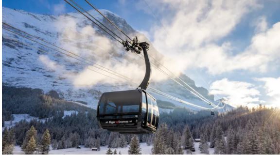
You can get closer to this Berner Oberland giant from the Eiger Gletcher train station by walking along the path behind the station. You will be awed by the Eiger glacier magnificently etching its way down from the Eiger but sheltered on the right by the protective Mönch. Interesting how glaciers are named, it could have easily been named the Mönch glacier but presumably the glaciologists had a reason. The Mönch was 4,100m when officially remeasured in 1996. Although the icy world of glaciers is shrinking, the Mönch's snow cap is growing and today it is usually noted as being 4,107m high. There is an inspiring one hour walk from the Jungfraujoch, Top of Europe train station via the Spinx tunnel to the Mönchsjochhütte. It is about 2 kilometres with 197m ascent, but mostly above 3,500m so don't rush and do not attempt it if the weather is foggy or stormy. The Mönch is still popular for climbers since it is in the 4000m category, unlike the Eiger at 3970m. First summited on August 15, 1857 by the local Grindelwald guide Christian Almer who had grown-up with the dream of reaching the Mönch summit as he cared for dairy cows in the alpine pastures below. Colleagues with Almer were Ulrich and Christian Kaufmann and Sigismund Porges from Austria. For experienced climbing alpine enthusiasts, the summit is considered a 'fast climb to a 4,000m'. There are actually 6 routes to the summit, but there is no easy highway. The South arm of the east ridge route is the most popular. Accessed about 15 minutes before the Mönchsjochhütte at 3650m, a rock ridge stretches down toward the glacier and you turn left to the rock, usually there is a pole marker there. Look for a rain gauge on the ridge as you go over loose scree. The ridge becomes narrow, and then you will need experienced climbing skills and proper climbing equipment with 50m rope, harness, 3 quickdraws, ribbon slings and wear a helmet. Naturally it is often iced over so you really do need experience and a resistance to heights when you walk along the narrow ridge. (Maps: Swisstopo 1229, Grindelwald; 254 T Interlaken) At the top of the Mönch is the border to the next canton called Valais, but there is no fence😆. Views of course over the magnificent UNESCO Aletsch Glacier are breath-taking but here, you will be surrounded by glaciers. You will feel on top of the world. In the direction of the Eiger on the left is the Eigergletscher, next to it is the Nollengletschen and Guggigletscher and to the right of the Eiger is the Obers Schmee and Ewigschneefälld. Behind you are the Jungfrau and Aletsch glaciers. The Swiss Alpine association has information here: Huts and Tours https://www.sac-cas.ch/de/huetten-und-touren/sac-tourenportal/moench-1194/hochtouren/ An overnight stay is a treat at the Mönchsjochhütte. You can witness the silence of dawn and the easing of a coloured sunset here as you enjoy quality Swiss hospitality. It is the highest manned hut in Switzerland and bookings can be made here at the hut itself. On 5 December, the new Eiger Express tricable gondola takes its first trip from Grindelwald Terminal to the Eiger Glacier station in just 15 minutes. Skiers will love this speed to the slopes. To the top in just 15 Minutes. The opening is right on Schedule see Nov 2018 Blog and it will make a huge difference in poor weather as well. The new station has plenty of dry areas that are a comfort in bad weather.
My Swtizerland updates Co Vid safety needs: "In Switzerland, there is an extensive obligation to wear masks: in public transport and in all public spaces where it is not possible to keep a distance (including outside areas of restaurants, of shops, in pedestrian zones, etc.). The information and entry requirements for all nationals can be found here More information When entering Switzerland from certain areas, it is compulsory to report to the cantonal authorities and to go into quarantine for ten days. The Federal Office of Public Health (FOPH) maintains a continuously updated list of these areas. The persons concerned will be informed in cross-border means of transport and at border crossings. Important: Travellers must inquire with their national authorities about the exact travel conditions before starting their trip. There is a Swiss app . Also this makes it a fast ride to the top to begin this summer Eiger walk. Photo: https://www.jungfrau.ch The study of glaciers is called Glaciology and taken from the Latin meaning 'frost ice'. Wikipedia defines glaciers as"an extended mass of ice formed from snow falling and accumulating over a long period of time; glaciers move very slowly, either descending from high mountains, as in valley glaciers, or moving outward from centres of accumulation". Stretching over 23 kilometres, the Aletsch Glacier in canton Valais is the longest in Europe, measuring 1.5 kilometres wide on average and 900 metres at its thickest point.
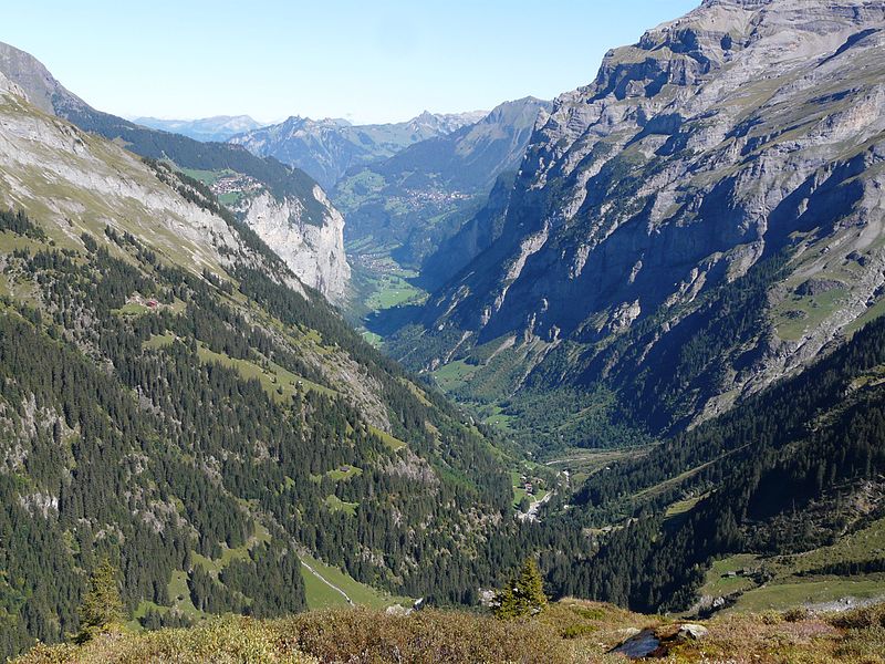
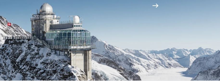
A train ride from Lauterbrunnen up to Jungfrau Joch will give you this most spectacular view. From its source in the Jungfrau mountain region at over 4,000 metres, the glacier flows down the valley at speeds of up to 200m a year. But in recent times it has also been beating a major retreat. Up here at 2,333 metres, you cannot hear the steady drip of melting ice down below. But over the years the cumulative effect has been devastating. “Over the past 40 years, the end of the glacier has shrunk by 1,300 metres,” explains Laudo Albrecht, director of Pro Natura’s Aletsch Centre, located near Riederalp in the heart of the Aletsch region. “But it’s not just shorter; it’s also 200m thinner.” see https://www.pronatura-aletsch.ch/de Over the next 50-100 years Switzerland could face a three-degree Celsius temperature increase due to climate change. Researchers believe that alpine plants could face not only warmer temperatures, but also deadly competition from unfamiliar species. Fortunately, no notable changes had been witnessed so far. 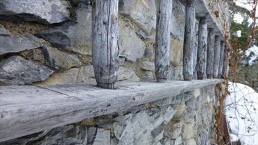 There are much evidence from the early Walser communities throughout the Swiss Alpine regions. Such as famous walking paths that originated from the Walsers as they traveled and moved their animals as part of their livelihood. Who were these Walser folk? The Walser were colonists. They moved out of the Valais Rhone Valley in the region 14th and 15th Centuries around 700 years ago and were given special land management and grazing rights in the high altitude settlement areas. The Valais people themselves are not counted among the Walsers. Dr. Johannes Führer defined the group: "Walser is the name given to the inhabitants of the historic Walser settlements in the heights of the Alps, in which the language, culture, economy and historical awareness of the Walser were or are alive in the 20th century." The long, snowy winters made these folk skilled in being able to store forage for their animals. The foundations of their barns were made from a wall built from unworked stones. A specific building style, the wooden ledgers of the stable and the round timber are connected in a log building, the walls are reinforced with stakes and tied to wooden cramps. Photo by Gloeggli in Gimmelwald. Several Walser communities came to the Berner Oberland region and some preserved Walser wooden barn buildings can be seen in Gimmelwald and Mürren. Nowadays the barns remain mostly empty since modern farming mostly uses centralized large stables. An old and empty Walser barn in Safiental (GR) has been renovated and opened to the public with the support of a public trust, to show an example for perfect preservation. As well as Gimmelwald and Mürren there were Walser settlements in Trachsellauenen (behind Stechelberg), ‘Ammerten’, (higher up above Trachsellauenen behind Stechelberg) and Walser farms in the Sefinental valley. Ammerton or Ammerten was a large settlement in the Ammertental behind Stechelberg. When and why this settlement was abandoned is unknown. It was mentioned in a choir manual from 1762 and Marc Théodore Bourrit from Geneva wrote in 1787: "Ammerten is still an almost lost home for people", and around the middle of the 19th century Peter Ober wrote “The village is no longer ". Perhaps the wave of emigration to the United States in the middle of the 18th century, included members of the Walser communities from the Berner Oberland region. Photo below: “Rear Lauterbrunnen valley with Undri Ammerta and Obri Ammerta on the slope in the foreground to the left of the center of the picture” Source: https://de.wikipedia.org/wiki/Amerton 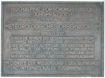 Not many people know about the significant research station on the Jungfraujoch. Built in 1937, it provides the infrastructure and support for scientific research that must be carried out at an altitude of 3’000-3’700 meters above sea level or for which a high alpine climate and environment are necessary. The buildings include the Research Station, Sphinx Observatory at Jungfraujoch, and lab space in the former Swisscom relay station on the Jungfrau East Ridge. The High Altitude Research Stations Jungfraujoch and Gornergrat International Foundation (hfsjg) provides the necessary infrastructure such as accommodation and support for scientific work for researchers from all over the world. No research is carried out by the Foundation itself. Some of the Research topics at Jungfraujoch with photos from www.hfsjg.ch 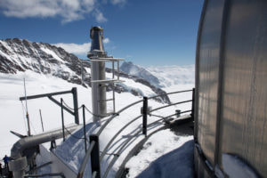 Meteorological measurements at Jungfraujoch that play an important role in the computer programs of weather forecasts as they show at what speed changes in the weather can occur. They have also identified trends of great importance as the consequences of climate change. Documenting the climate change since Jungfraujoch is far above most sources of air pollution, the High Altitude Research Station is suitable for measuring the composition of the atmosphere. 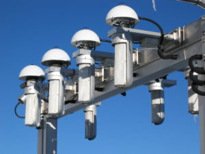 Monitoring the radiation balance: Radiation is the driving force in energy exchanges between the atmosphere, the oceans and the ground: the most direct effect of global warming is expected to be an increase of infrared radiation emitted from the atmosphere to the ground. Long-term observation of surface radiation fluxes is consequently an important part of climate change monitoring. 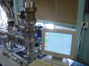 Understanding Aerosols: Since the 1990’s research to gain a better understanding of how the fine suspended particles in the air affect the climate and cloud formation. 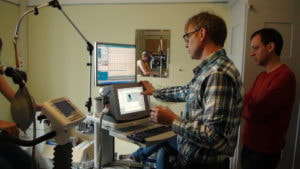 Medicine: The effects of a high-altitude stay on the human body has been a focus for many researchers. Investigations into cardiovascular systems, correlations between blood gas values, symptoms of acute altitude sickness and how heart patients handle an altitude above 3’000 meters. Although there is special accommodation for researchers at the station, there is nothing publicly available.
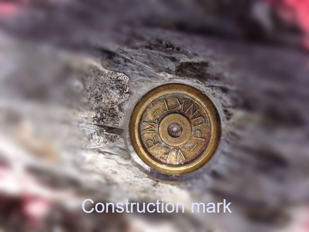
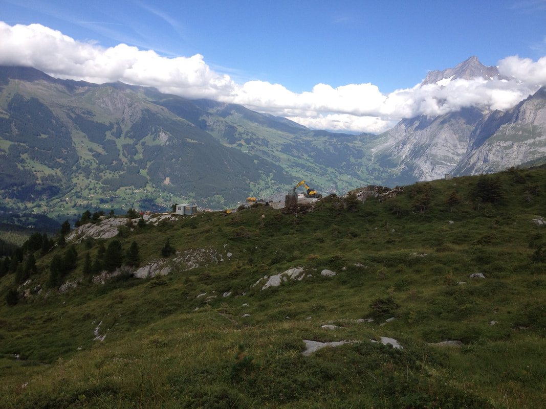
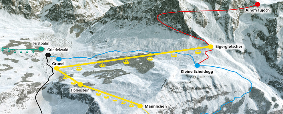
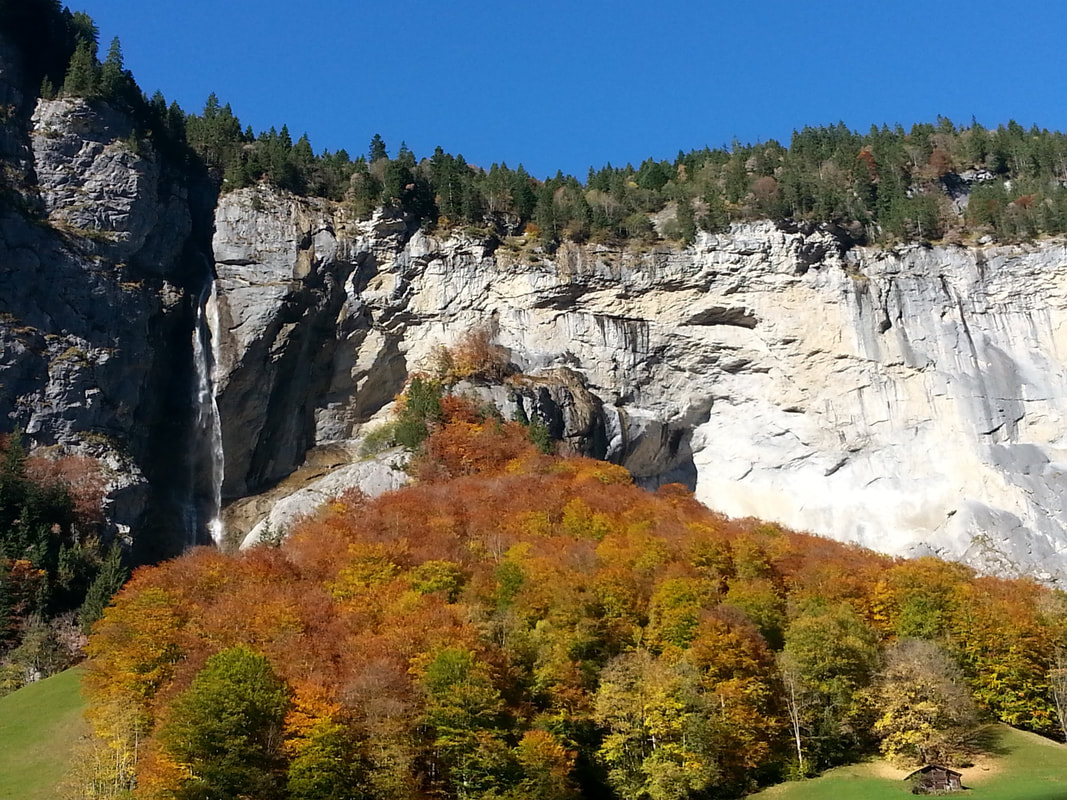
A day trip to the Jungfraujoch is a special day that one remembers for many years. There are diverse areas to explore such as ice caves, the views and an hour walk (maybe strenuous at altitude for some people) to the Mönch Hut in good weather also reveals the glacier world. The view of the magnificent UNESCO protected Aletsch Glacier is breath-taking. Be sure to check the weather the day before your outing for optimal photo opportunities and the walk to the Mönch Hut. Be on the first train leaving Lauterbrunnen around 7am to avoid the crowds and pre-buy a ticket in summer as they have limited capacity on the trains (around 3500 seats per day). In the homeward train journey, alighting at Eigergletscher station is well worth the side walk around to better see the Eiger Glacier. Then you can walk down to Kleine Scheidegg enjoying the views and the musical cow bells. Re-joining the train at Kleine Scheidegg before another hop off stop at Wengen for some village browsing before getting back on the train to continue to Lauterbrunnen. These side trips can make the day a full and colourful adventure. A 470 million Swiss franc project that will speed people to the Eiger Glacier from Grindlewald. And will be ready for skiers in December 2019. These slopes will surely have more official ski runs added to them as the area already attracts off piste enthusiasts. Construction began in July and significant progress has been made through the summer I discovered on an off trail walk. Finding this construction mark was an interesting point in the middle of a a rocky site and heath as in the photos above. Although the traditional Eiger North Wall trail was re-routed, it has enabled hikers to see the reality of building in such a harsh environment. The Grindlewald- Männlichen 4 person cable car will be retired next year with a faster 10 seat cable car so we can look forward to faster turnarounds in our ski run times. Not so fun taking 40 minutes in the cable car for a 20 minute ski run, unless you're having a picnic on the way in the cabin. Some people think that walking and time in the mountains is all over after the 30th September. However this is simply not true. October can be a glorious month of long days ending with some crispness but brilliant blue skies and golden colours. Hence the popular name Golden October.
The colour of the sky on these clear days is a stark blue, possibly due to the colder higher temperatures. Often the sunsets will be glowing after such a stunning day and you wish the day wouldn’t end. The crowds have waned and there is still so much to enjoy on the trails. Late blooming flowers still enjoying sun will delight you and the meadows are quiet since the cows have usually been returned to the lower grounds in this month. From Wengen catch the cable car to Männlichen. Enjoy a little steep walk via the Royal Walk to the Crown and marvel at the 360 degree view.
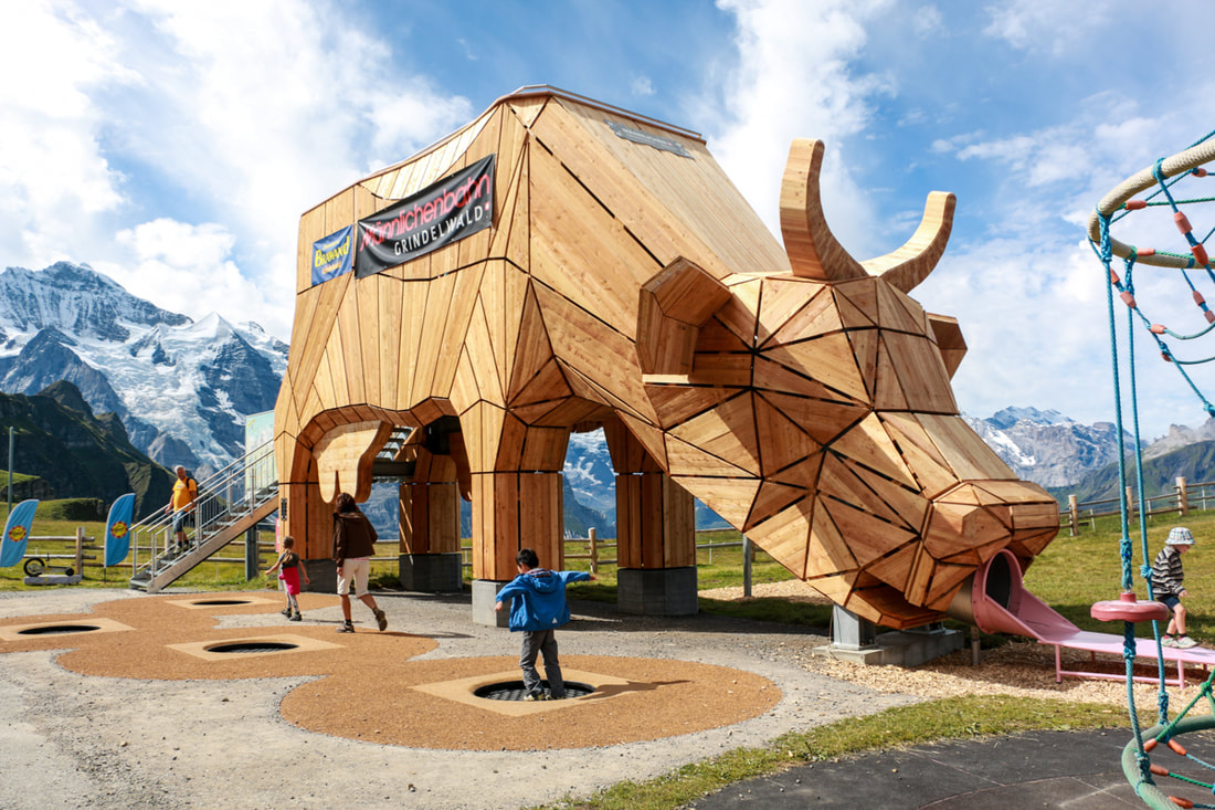
Then time for coffee at the Sennespielplatz playground at Männlichen. The giant cow slide is surrounded by swings, a seesaw, spinner, bowling, and a rope swing that you can also lie back and relax on in the sun. Then back on the Panorama trail to Kleine Scheidegg, with easy walking over 4.7 km, (about 2 hours with children) and gradually descending about 200m. The trail is OK for all-terrain strollers with big tires. There are cafes at Kleine Scheidegg but nothing along the way. The train ride back to Wengen and Lauterbrunnen would be a better choice rather than walking if your children are small. And a faster route to the next playground in Wengen J 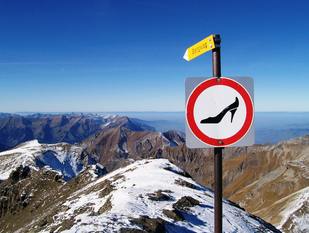 The Schilthorn reaches 2,970 m (9,744 ft) and is a lovely day out to see the James Bond Museum and walk down to Murren and enjoy totally amazing views along the way. The cable car and or train ride up are also a pleasure and you can see where you can then later walk back from the top if you choose. From Schilthorn to Birg, Birg to Murren and Murren to Grutschalp will take you about 4 hours after your lovely lunch at the revolving restaurant on the summit. From the top of Schilthorn you feel like being on top of the world. There are 2 exit points to pathways out of the Schilthorn. You need to take the one at the front of the building that faces the Birg station to take the easier and safer path down to Borg. The other path takes you down a different valley, so be careful. You will know you will be on the right path when you see this sign with the high heel shoe. Yep, crazy as it seems, many tourists are trying to get a better picture by tottering and teetering down the rocky path. I have suggested to several tourists before that simple tennis shoes will not be a good idea down the steep and stony path where there is a fixed cable in case the stones slide under your feet and you get that slipping sensation. I think tourists do not realise that the open red circle means: stop, don’t go here. But hopefully the humour of the shoe heel image would help them to work that out! After passing Birg and making the cliff walk over the glass and wire pathway – total fun, the path continues along a rocky road and then into ‘Heidi – land’ through the meadows below. Listening to cow bells and sitting in the grass to enjoy the flowers and the towering alps and glaciers around you will see the day disappear fast. p.s. Hiking boots and sun screen necessary An average grade mountain path, marked red and white, suitable for confident walkers with strong soled walking boots for slippery sliding rocks. What is not average, is the scenery. From start to finish, you will have a well exercised neck and camera finger.
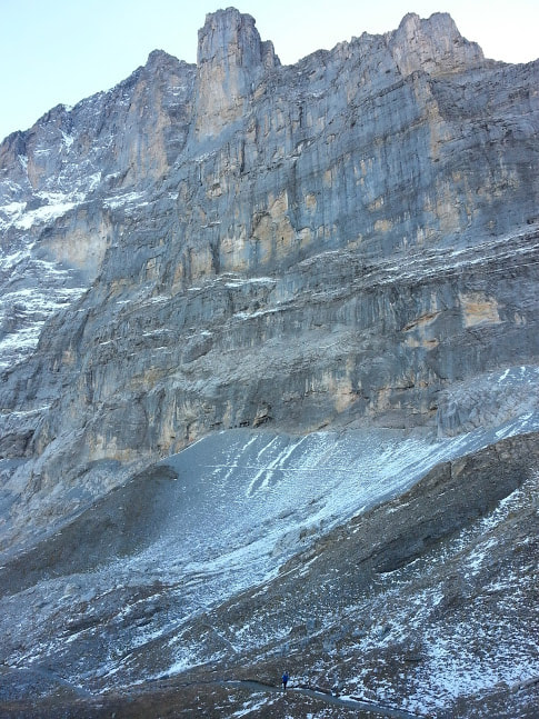
It’s a highlight. It’s called the Eiger trail. Getting a head start from the Eigergletscher train station above Kleine Scheidegg and then down to Alpiglen is about 3 hours. Many people walk up from Grindlewald or Alpiglen, however beginning from Eigergletscher where you can look out over both sides of Kleine Scheidegg and be fresh to take in its grandeur and breath in deep the mountain air and feel its calmness, rather than being relieved just to make it your finish point if you begin from Alpiglen. Many keen over 70 Swiss people will be making the uphill route. This moraine path is also part of the 101km Eiger running trail held in July each year. The green dot highlight paint you see on the rocky path here and there are guides for this superhuman race. Walking under the shadow of this 3900m giant or Ogre is it’s translation, is simply awesome. One cannot imagine how it was first climbed in 1858 with the heavy climbing equipment of their day. This ogre has claimed many lives of those who would want a higher view or the base jumpers from the lower mushroom rock on the Eigergletscher side. It is a majestic mountain. The colours, the changing textures, the hidden gurgling water springs give plenty to discover. But the sense of enormity is the sensation that remains when walking this high way. I praise God for His even greater enormity and I didn’t want the rocks to be crying out while I was crossing over them. See the tiny person in blue on the path at the bottom of the photo. Small things are hard to find in this area of massiveness. The mountains, the rocks, the panoramas, all seem just massive and one feels like an ant amongst this massiveness.
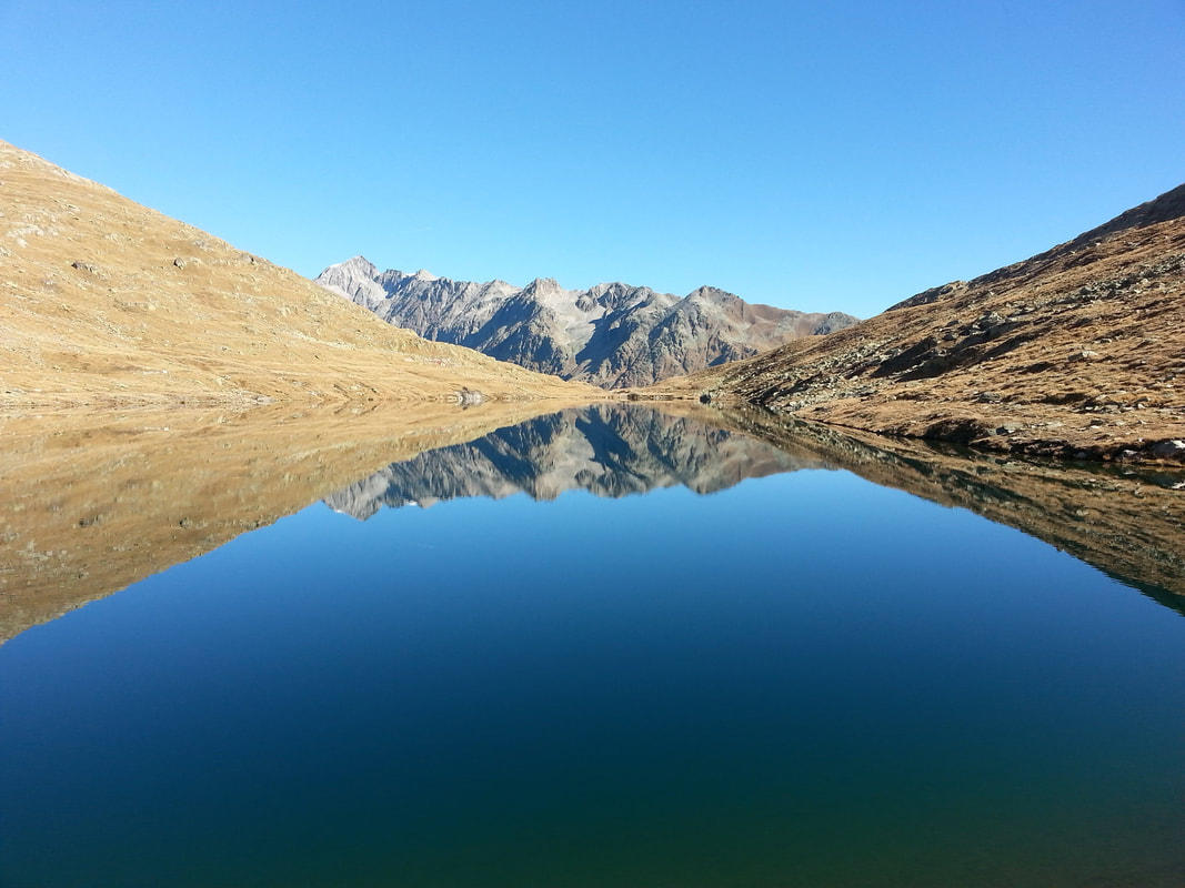
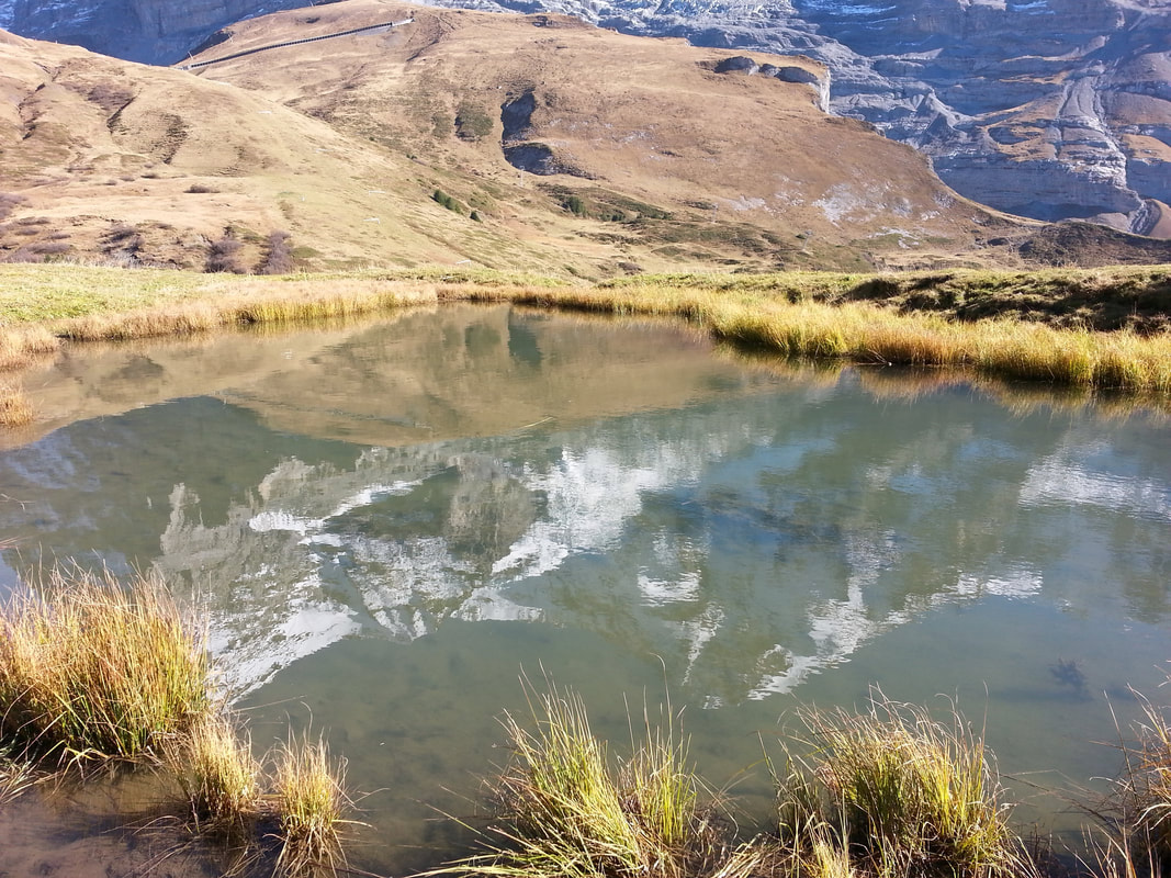
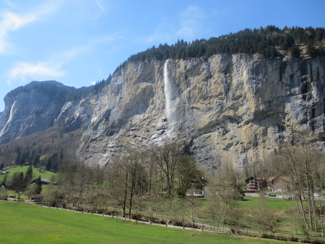
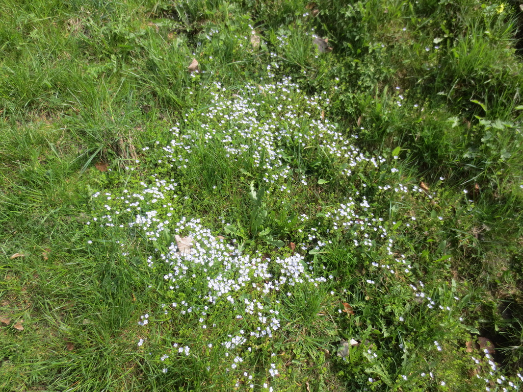
Standing in awe at the Eiger, Monch and Jungfrau (the EMJ) from Kleine Scheidegg or up from the Lauberhorn behind, continues to be my favourite view. It is a small grassy hill climb up to the Lauberhorn, famous for being the starting peak for the World Cup downhill ski race each January. You can even walk through the starting gate hut. Even here, on the Lauberhorn, the massive mountains, each with their own glaciers, continue to touch the sky and remain massive. So a small delight on the walk down from Kleine Scheidegg to Wengenalp is this small refection lake. Not known to many, passed by those in a hurry or who are still photographing the EMJ and overlooked as too small to stop for by others. It is worth the stop. Hear the creaking and spot the frogs. Of course you want to capture the reflection of the massive EMJ behind. Here in this Autumn photo, you can see all three mountains. In 12 weeks it will be blanketed under fresh white snow. A little wind today and the Staubbach Falls are spraying a wide mist as they tumble down in this between-season time. The sun for many hours on the balcony, from the long daylight saving days makes lazing with one’s feet up on the railing an easy activity. While the trees are not yet dressed, the fish are easily seen and buzy in the Lüterbach stream below the balcony as in this image. Some local boys come to try their luck fishing in the Weisse Lütschine (White Lütschine) opposite the apartment in the image above. Their nets and rods give them lots of fun but they went home with an empty bucket. The Weisse Lütschine has several tributaries that you can see as you walk along the path opposite the apartment heading up towards Stechelberg. Many named and unnamed gushes from the massive high walls as waterfalls down the steep cliffs. One is into the Staubbach Falls and also the Trümmelbach Falls (the water fall inside the mountain you must visit) and the Schmadribachfall. The highest waterfall in Switzerland is here, the Mürrenbachfall, with a height of 417 meters that enters into this Weisse Lütschine. Is there a Black Lütschine? Yes ! The Schwarze Lütschine, or Black Lütschine, flows from Grindelwald to Zweilütschinen or Two Lütschine. You can see the two rivers mixing their colours under the bridge by this train station of the same name. Fund rafting experience is to be had from down the Schwarze Lütschine while the Weisse Lütschine challenges solo canoeists who begin their adventure opposite the balcony of the apartment. They are quickly out of sight and we often wonder what that would be like. The spring flowers are bursting out. Blues, yellows and whites, making a carpet on the meadows. See the heart in this group of flowers? What a picture, I couldn’t believe it.
It is a great time for holiday accommodation as the village is not buzy and there are no crowds and everything feels fresh and the air is warm. Yes there are some rainy days, but that makes the grass green and I saw the first cows let out today from their winter stalls. They were crazy hungry for that new green grass they have missed all winter while being indoors. The variety of flowers and grasses in the meadows is one of the secrets to the flavour of the milk and cheeses made in the Lauterbrunnen Valley. We walked up along track 49 (Jungfrau Wandern Hiking map) to Wengen through these flower bursting meadows along the well-marked path and through the forest. We did not see a Chamoix or Gemse (Mountain Goat), these are the most common although we have seen them previously when they get surprised and are caught loafing off in the shadows when a person comes by on the trail. Then they spring in a flash and a rush past you as you wonder “what was that?’. There are a few of the larger Reh Deer and occasionally an Ibex or Steinbock you can see in the cliffs. Although there is a hunting season, there is plenty of fodder on the slopes for all. Wengen is a “must see” visit with another Bäckeri (bakery) with delicious cakes, bread and sandwiches. Take your purchases to the seats at the lookout by the church to enjoy the most spectacular view of Lauterbrunnen. Need a few groceries for dinner? There is another Coop supermarket, prices the same as the ones in Lauterbrunnen and Interaken, so one canbuy more fresh bread and cheese before walking down the track 48 (Jungfrau Wandern Hiking map) other path to Lauterbrunnen. Being on holiday means not so much cooking but since it is still light until late, we often eat supper on the balcony. Our kitchen has most culinary tools one could need and tonight I prepared sautéed mushrooms and zucchini with local Lauterbruunen butter then steamed with lashings of quark #. Served over spiral pasta with super diced thinned sliced local ham from the Metzgerei (Burcher) in Lauterbrunnen. Fast, easy and delicious! – Guten Apetit! # Quark is amazing. It is a fresh acid-set cheese. Traditional it is made without rennet, but in sometimes rennet is added. Low fat (wow so lucky) like yoghurt in calories, it is smooth, soft, white and thicker than cream but not fatty. One can use it in everything. From making a dip, spreading on crackers or with vegetables, to making soup, stirring into vegetables, which I did tonight, or topped with honey for breakfast, yumo! Most people know of Rick Steves. For over 30 years, his global travels have inspired and helped others to enjoy magic places often overlooked by the regular tours. Read his review on Gimmelwald below, one of the best views of the valley from here and a cute mountain village. From the Eyhus5 apartment walk or take the bus to Schilthorn cable car station and up to Gimmelwald and cable car to Mürren and then hike back down to Gimmelwald. Be sure to spend some time admiring the Muerrenbach waterfalls next to the Schilthorn cable car station. They are slightly taller that the Staubbachfall and you can get closer to their thundering waters. Or take the cable car from Lauterbrunnen to Grütschalp then the little train along the cliff to Mürren (we prefer to walk instead of taking the train, a nice 90-minute hike alongside the classic postcard view). Walk down to Ginmmelwald after experiencing Mürren (20 minutes), then Take the cableway down to the valley and the bus back to Lauterbrunnen. Or walk back down, about 2 hours, through a lovely forest with an amazing waterfall on the way, very cooling on a hot day. Buying a Berner Oberland Pass will cover all of these lifts and trains. Every two years my guidebook research brings me to my favorite corner of the Swiss Alps, as I visit my friends who run the little places that accommodate my traveling readers in the tiny village of Gimmelwald. |
Eyhus 5
Where dreams begin for outdoor adventures in the inspiring Jungfrau region Categories
All
Archives
July 2024
|
|
Eyhus 5,
3822 Lauterbrunnen, Schweiz Email: [email protected] About Us: We love the Jungfrau Region and enjoy helping guests to plan and discover the beauty here for themselves. Summer, Winter, Spring and Autumn each have their opportunities to give inspiration in this amazing Playground. |
|


 RSS Feed
