|
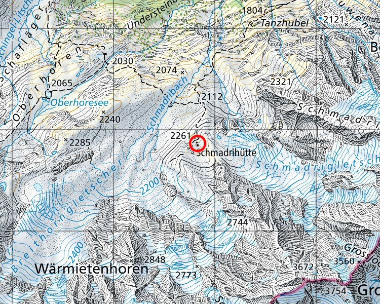
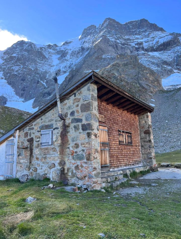
Ever wanted to sleep high in the mountains, say 2260 meters in a cozy rustic mountain hut? Only sleeping 8 people with a confirmed reservation, the Schradrihutte is at the south-east end of the Lauterbrunnen Valley in the nature reserve called Hinteres Lauterbrunnental. Coordinates WGS 84: 46.49914, 7.89231 or 46°29'56.921″N 7°53'32.313″E The wardens are not on site but wood and basic Cooking facilities with wood stove are supplied. Only 1 lamp, so bring some candles, and running water is about 30m south of the hut. Rustic, quiet and just a beautiful walk to arrive there. From Stechelberg, in the direction of Oberhoresee via Tanzhubel and up beside the magnificent Schradribach Waterfall, you will be well rewarded with stunning views and in mountain peace. Reservations here: https://www.aacb.ch/huetten/schmadrihuette/#OnlinereservationSchlafplaetze 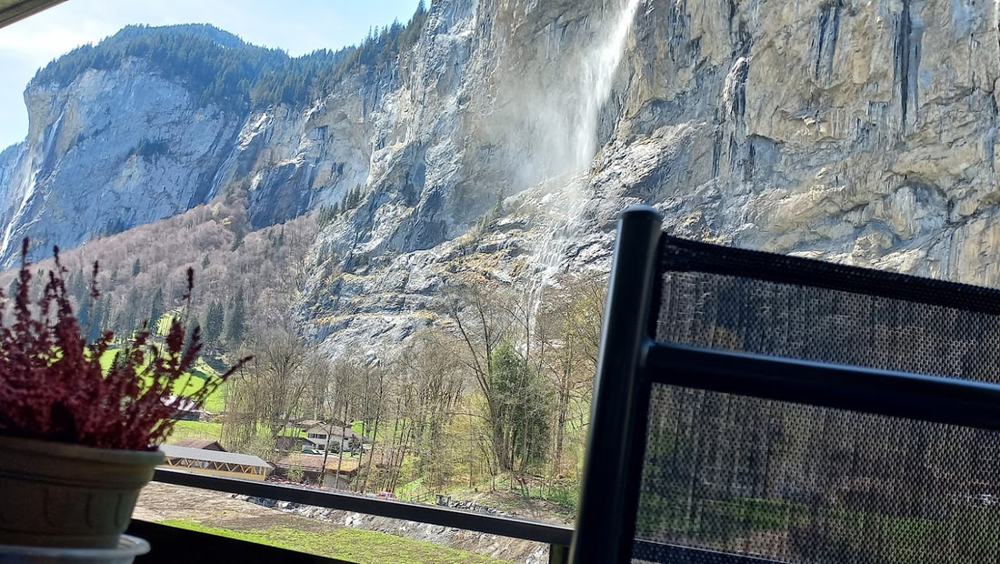 “I almost wish we were butterflies and liv'd but three summer days - three such days with you I could fill with more delight than fifty common years could ever contain.”
― John Keats, Bright Star: Love Letters and Poems of John Keats to Fanny Brawne 3 kilometers, 600 meters in altitude and an average gradient of 20%.. 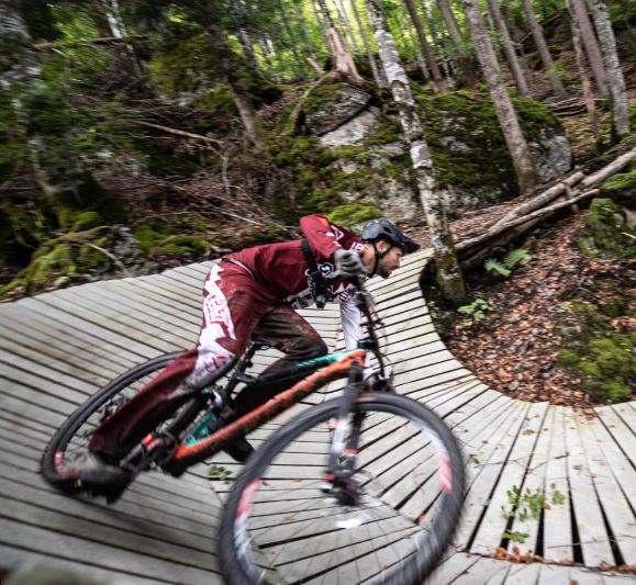 Photo from https://velosolutions.com/
The Grütsch trail in Lauterbrunnen offers advanced bikers a real challenge. The ground is constantly changing. From the dusty ground to rocks, roots and North Shore elements, everything is there. The trail is steep and the turns are tight. Nevertheless, the track is incredibly smooth. "As the name "Grütsch" already suggests in Bern German, it is a large landslide. The big boulders in the lower part of the route were an enormous challenge for the shape crew. Since blasting was not a solution, the crew quickly built north shore constructions over the cairns. The cable car takes bikers comfortably to the start on the Grütschalp. When you get hungry or thirsty, you can sit on one of the terraces of the base bars on Dorfstrasse. And Vernon at Imboden Bike shop in Lauterbrunnen can fit you out with whatever bike gear you need. People often ask when is the best time for wildflowers in the Berner Oberland region. There are actually waves of different wildflowers from June to September. The elevation and sun facing slope angle also play their part. At lower altitudes, Spring starts in May. At Schynige Platte, the Alpine Garden at 1970 metres there mostly opens middle of May. It finishes toward the end of October (23rd October in 2022) when one sees seed pods and autumn colours There are different categories such as endangered species and climate change affected species. See www.alpengarten.ch Admission is part of the 126 year old cog rail train fare from Wildersvil and there are often tradition alp horn players there and a ch8ice of short and long walks that overlook the stunning aqua coloured Brienz Lake. Because it is the mountains, the weather is unpredictable. Snow in September was a surprise this year. However nature is full of surprises and not to be assumed. 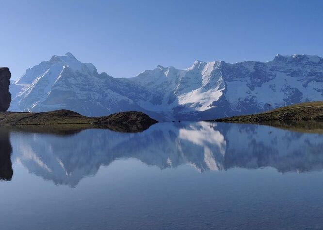 One of my favourite walks. This mirror lake, the Grauseeli, is just a little walk down from the Birg Cable Car station on the Schilthorn Cable Car route.
Hardly anyone visits it although most visitors on the cable car ride up to the Schilthorn may see it if they look down. It is on a walking track that leads down the valley, also one that is not so often walked. It is a red and white, mountain grade track. The full day walk (7 – 8 hours) can be done in a loop over the 11.06km with an ascent of 967 m and a descent of 964m. Beginning in Mürren and taking the path up to the Allmendhubel and then continuing up some steep parts to the Schilthornhütte which is open Fridays – Sundays from July to September for a refreshment stop before heading higher where you can see the Birg Cable car station. It is a wide and well signposted track. In winter it is part of the ski run down to Mürren and in summer it is part of the Inferno triathlon. It is a little steep down to the lake but a lovely place to rest, take a swim and many photos. The walk continues down the steep and often rocky Schiltalp trail. The rocks can make it slippery so it is best not to hurry. You will wind your way down to Mürren via the Northface trail or a longer choice is over to the Rotstockhütte for afternoon tea before walking into Mürren. A long but rewarding day facing the stunning scenic mountain range the whole day. Some days are just right for a BBQ and you wish you could find one! There are several free BBQ places around the Lauterbrunnen Valley that also have firewood supplied and rustic tables and chairs. They can be hidden gems to find when the little kids have had enough walking and need to rest. This gives a good time to get the fire burning and coals just right to grill locally made sausages from the Butcher in the middle of Lauterbrunnen. While it takes a little preparation to think ahead to bring some paper and matches and a few “tools”, it is a time to take time and enjoy the experience and the surrounds. Here are a few locations: At the Schmelzofen (Photo) or Smelting furnace from the 17th century, along the track beside the Weisse Lütchine about 10 minutes walk from the Zweilütschinen train station. It is about 30 minutes’ walk from Lauterbrunnen along a gravely path so not so good for strollers from this direction. It is well shaded and the kids can explore the inside of the old oven. GPS 46°37'16.9"N 7°54'13.7"E In Lauterbrunnen there is a Grilling place with stunning views of the valley and of the Staubbachfall and Spiss waterfalls. In fact, the closest waterfall is called Spiss. This is also under some shady trees and along the paved farm road, it is easy for strollers. From the Carpark next to the church, walk past the Staubbachfall after filling up your water bottle at the water fountain there 😊 and keep walking up a slight rise with a dairy on your right you will soon see the Fireplaces and tables on the right. Such a rural scene with the cows usually in the surrounding meadows and the Weisse Lütchine rushing along below. GPS 46°34'57.9"N 7°54'37.4"E Behind the Schilthornbahn cable car station, not far from Stechelberg, is another grilling place wit ha stunning view to the mighty Mürrenbachfall. You can catch the bus to the cable car station and walk over the bridge or walk along the road from Lauterbrunnen past the Staubbachfall for about an hour and when the road becomes a gravelly path for about 200 metres you will soon arrive at the fireplaces on the right. There are toilets at the cable car station and a fresh water fountain ‘mountain style’ at the BBQ place. Lots to look at here with many para gliders landing o nthe grassy area behind the carpark. GPS: 46°33'21.6"N 7°54'02.3"E The fireplace is a little outside of Wengen along the trail towards the Leiterhorn, Burglauenen and Männlichen. The area is a bit hidden as it is behind and above a row of old dark brown traditional barns. There is lots of shade and a forest to play in as well as the view GPS 46°36'44.7"N 7°55'06.4"E Naturally it is like hiking, you want to just leave footprints and a clean plate for the next people. 👣 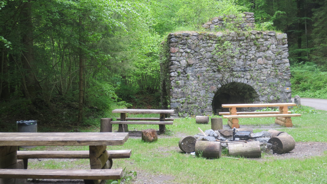 Schmelzofen BBQ place not far from Zweilütschinen rail station From Iseltwald one can catch the tiny cable car to Sulwald at 1500 metres for an authentic Alpine experience. First, catch the Mini Post bus to Iseltwald from next to Lauterbrunnen Train Station, in front of the Steinbock Hotel. The bus ride takes you through a kilometre long spiral tunnel and around hairpin bends. Better than driving. Iseltwald offers a steep village short stroll to view the traditional and quaint houses that overlook the Lauterbrunnen Valley and beyond. After your private ‘air lift’ in this tiny romantic cable car with very friendly staff to send you on your way, you can have a morning coffee at the Café, Sulwald-Stübli. You can choose from many trails and look around at the variety of homes in this unique village. A relatively easy walk about 90 minutes is to the Lobhornhütte at 1955 metres for lunch. You get the most stunning views of Eiger, Mönch and Jungfrau, (known as E,M, J) along this trail and see the traditional high summer dairy industry. An almost ‘all the way’ paved walk to the Sulsbach waterfall is also worth the 40 minutes, You can also walk to Grütschalp., about 2 hours. But if you have already bought your return cable car ticket that will not work. So you need to decide where you want to go for the day 😊 There is also some fun Scooter action called Monstertrooti is a 4 km ride for the kids to do on Sundays Sulwald to Isenfluh. www.isenfluh.ch
The Hardergrat trail is a 24 km ridge hike, starting from Harder Klum at Interlaken. “GRAT” means ridge in German and Harder is only a name but it is a “harder ridge” 😊 This spectacular ridgewalk is ONLY for people who do not get dizzy as you are walking along the exposed ridge most of the way. The ridge drops steeply on both sides, like 1500m steep!, that’s steep. There is no water or food so you must take it all yourself and start before sunrise as it’s over 10 hours long with a 3000m elevation gain. You must also plan your day and read the map before your go, if you don't make the Brienzer Rothorn’s last train down to Brienz you will have another 1700m down, probably in the dark. NEVER DO THIS PATH IN THE WET. But a “taster thrill” walk exists. Catch the funicular from Interlaken to Harder Klum. Then from Harder Kulm follow the sign to Augstmatthorn (3 hours and 30 minutes) to the feet of Suggiture is mostly through the forest walking up about 400m of elevation taking around 80 minutes to reach to “the feet” of Suggiture. Coming out of the forest you will see the Suggiture. Climbing up the Suggiture is steep and very rocky, but also very short. It is about 150 m of elevation gain and about 30 min to reach Suggiture. (photo below) From Suggiture to Augstmatthorn is walking along the ridge . From Augstmatthorn and way back you can walk down the steep trail to Lombach (about 45 minutes) and then walk another 1-1.5 hour to Habkern and then take a bus to Interlaken. P.s. be sure to check the bus schedule as they are infrequent. This “Taster thrill” walk whet your appetite to prepare for the whole 24 kilometers. 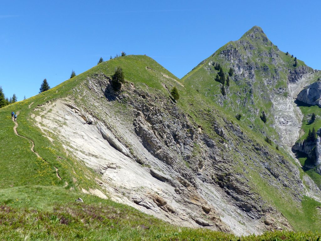 Yes, but with a permit. There are lovely lake or brown trout there. Only from Mid-March to end September. You must be able to agree to fishing by the methods stipulated by the Bern Fisheries department and it is quite costly. New regulations from 1 January 2020 say that a Bern fishing license can in principle be obtained by anyone - with or without a residence in the canton. Although you can buy online, it will be posted otherwise you can buy from Tourism office in Lauterbrunnen. The fee system is a bit complex, but basically a weekly permit is around 100 CHF. It is personal and non-transferable and you need to report back the catch statistics. Each person who is fishing needs a license even if they share the rod except for kids under 9 if their accompanying adult has a permit. You can find information here: www.vol.be.ch/vol/de/index/natur/fischerei/angelfischerei/patente/preise.html While it could all sound a bit hard, the good news is fishing without licence is allowed in Lake Brienz and Lake Thun. There you can find your own nook around the lake, spread a blanket on the grass and enjoy a picnic while you wait for your catch. Of course there are some rules to observe such as fishing from the shore with a single rod and only one single barb- less hook is allowed. Naturally limits to numbers and sizes apply, so best to investigate the above website further. 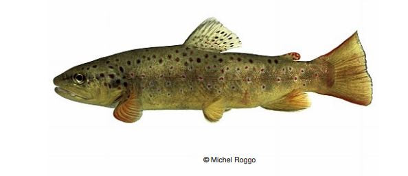 Kornbalmhöhle GPS Co-ord: N 46° 35.047 E 007° 55.003 October is a great time for walking in Lauterbrunnen and the Jungfrau. Many golden colours come out, the crowds have gone and there are lots of discoveries to be made in this quiet and serene season. Have you discovered Geocaching? Do you have a sense of adventure? Geocaching takes you to places that you most likely would never explore. One such place is the Kornbalmhöhle, a cave high up on the Wengen side of the Lauterbrunnen Valley towards Stechelberg as shown by this Photo from http://vanzon.nu/ https://www.geocaching.com/geocache/GC3WR80_kornbalmhohle?guid=63814f8e-3386-4ab6-997c-d8763d2aa26c It is a steep walk up to these unusual caves with fabulous views back to Staubbach Falls. Good solid shoes and clothing are a must, as well as a sense of balance, scrambling skill and adventure. Even if you don’t find the cache inside (bring a torch), the view and scramble is worth it. It is not an outing for everyone, but it has a real sense of exploring and sitting on the boulders and cave entrance gives you a sense of smuggling or hidden treasure. The treasure of course is the beautiful view that everyone else forfeits since they lacked the curiosity to seek out these caves. 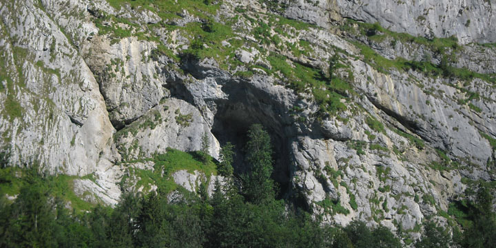 
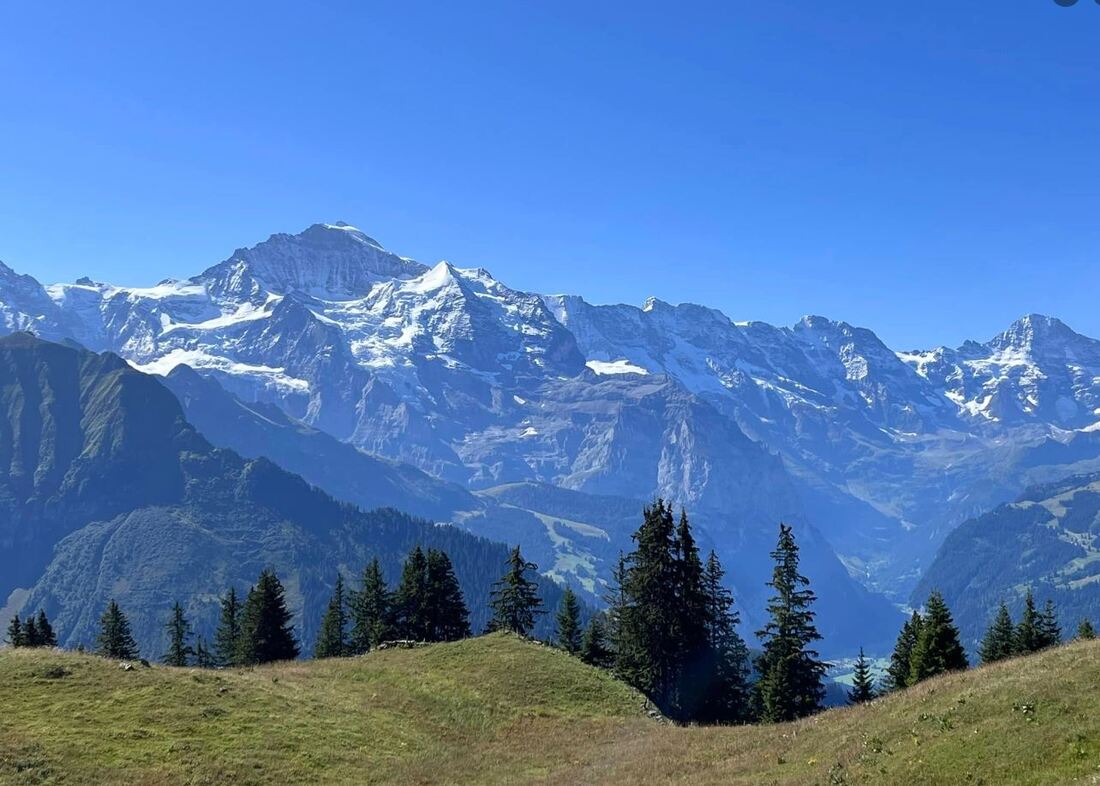
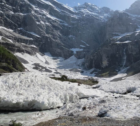 An easy walk to a real glacier is possible. Search on your tube for Kilchbalm and you will find someone’s vid of this magical place that no one seems to know about and it’s not far from the apartment.
Kilchbalm (Gimmelwald - Sefinental - Kilchbalm) Glasier Time one-way: 1 1/4 hours Distance one-way: 2 3/4 miles (4 1/2km) Lowest point: 4134 ft (1260m) Highest point: 5046 ft (1 538m) You can get cable car from Schilthorn Bahn up to Gimmelwald. (Bus from outside Eyhus along to Schilthorn Bahn in the direction of Stechelberg) The gradient is not very steep, and you can walk to the very end of the Sefinental valley, where only freezing-cold streams flowing from the snow and ice ( real glacier) and the heartiest vegetation exist. There is a small hut along the way , but it is lovely to have a picnic at the end. The scenery is beautiful in both directions. Since there is only one road in Gimmelwald, it is difficult to get lost. Where the road loops back on itself, by the fire-house, is a road leading into the Sefinental. From this point you can see all the way to the end of the valley and quickly realize that the end is not much higher than Gimmelwald. After walking downhill for 7 minutes you will come to a bridge that crosses a torrential waterfall that has gouged deep holes, through the years, in the side of the mountain. It now flows deep in the rock and splashes from pool to pool, plunging some 20 feet into a huge cavity beside this bridge to continue its way down to the valley floor. This waterfall is the same as "Sprutz" higher up and is called the "Schiltbach" which is the stream created by the runoff from the Schilthorn and the Schiltalp. After walking 8 minutes further you pass a firing range where locals come to practice, usually on weekends. A minute more and you come to the end of the road and the beginning of your ascent on a rocky trail. Here a signpost says that Kilchbalm, your destination, is 1 hour away. (It is also from this point that you can stay on the main road which leads to a trail that descends to Stechelberg or back up to Gimmelwald.) As you leave the main road and continue straight ahead through the gate, the mighty snow covered ridge on your left, called the Tschingelgrat, grabs your attention. Watch this ridge for avalanches which occur frequently and at any time. Soon you're walking through a dense forest with the Sefinen Lutschine swirling and splashing on your left side, where it will be all the way to the end of the valley. 15 minutes later, after passing some old sheds and massive rock overhangs, you come upon an old storage building from 1812 raised up on rocks. Next to it is a cable attached to the cliff above used for transporting logs. Shortly the path becomes very narrow and rocky. In 7 minutes you pass through the second gate and in a few minutes more you'll cross the first bridge. At the third gate, 7 minutes later, the path splits. (Note: this area has been known to be full of snow well into the early summer months, depending on the previous winter you should exercise extreme caution and perhaps turn back here if it is too dangerous ). Assuming the way is dry, you will take the lower path, to the left (If you were to continue on the path to the right, you would pass a tiny waterfall, perfect for splashing under on a hot day, and eventually arrive at Boganggen and Rotstockhutte 600 meters higher up the mountain). Just behind the trees, around the bend is a grassy meadow and an alp hut. Occasionally cows are brought here for summer grazing. The farmer will stay here with his herd until it's time to move to better pastures. It is beside this hut where the Sefinen river, on the left is joined by the Sefibach, on the right, which comes down from the Sefinen alp. Following the path, close to the river, soon brings you to a second bridge. Before crossing the bridge, venture up to the waterfall created by the Sefibach but be careful of falling stones and branches. Once across the bridge you come to the steepest part of the trip. Here you witness the power of the Sefinen river. In spring and during heavy rainstorms this river is so swollen that it violently tears at the hillside bringing tons of rock and debris down with it. Once at the top you can rest on the last bench before reaching the end of the valley and the Kilchbalm. We think that Kilch is the word for goblet or cup and you will see how this valley looks like a deep cup. The towering cliffs make it a spectacular setting for a picnic without crowds and you will want to stay forever. Small things are hard to find in this area of massiveness. The mountains, the rocks, the panoramas, all seem just massive and one feels like an ant amongst this massiveness. Standing in awe at the Eiger, Monch and Jungfrau (the EMJ) from Kleine Scheidegg or up from the Lauberhorn behind, continues to be my favourite view. It is a small grassy hill climb up to the Lauberhorn, famous for being the starting peak for the World Cup downhill ski race each January. You can even walk through the starting gate hut. Even here, on the Lauberhorn, the massive mountains, each with their own glaciers, continue to touch the sky and remain massive. So a small delight on the walk down from Kleine Scheidegg to Wengenalp is this small refection lake. Not known to many, passed by those in a hurry or who are still photographing the EMJ and overlooked as too small to stop for by others. It is worth the stop. Hear the creaking and spot the frogs. Of course you want to capture the reflection of the massive EMJ behind. Here in this Autumn photo, you can see all three mountains. In 12 weeks it will be blanketed under fresh white snow. 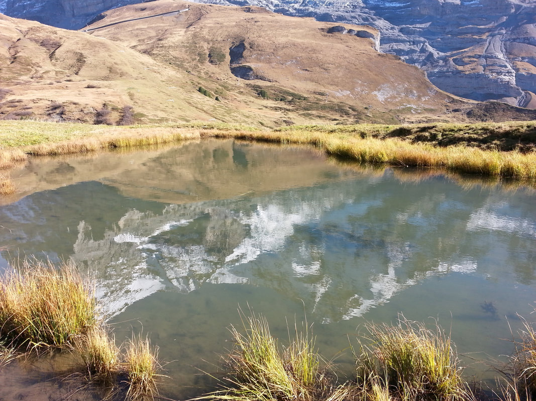 |
Little stream below our balcony
Eyhus 5
Where dreams begin for outdoor adventures in the inspiring Jungfrau region Categories
All
Archives
July 2024
|
 RSS Feed
|
Eyhus 5,
3822 Lauterbrunnen, Schweiz Email: [email protected] About Us: We love the Jungfrau Region and enjoy helping guests to plan and discover the beauty here for themselves. Summer, Winter, Spring and Autumn each have their opportunities to give inspiration in this amazing Playground. |
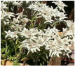
Edelweiss Flowers
|